You are here: Home > Network List > TA - USArray Transportable Network (new EarthScope stations) Stations List
> Station X43A Marvell, AR, USA > Earthquake Result Viewer
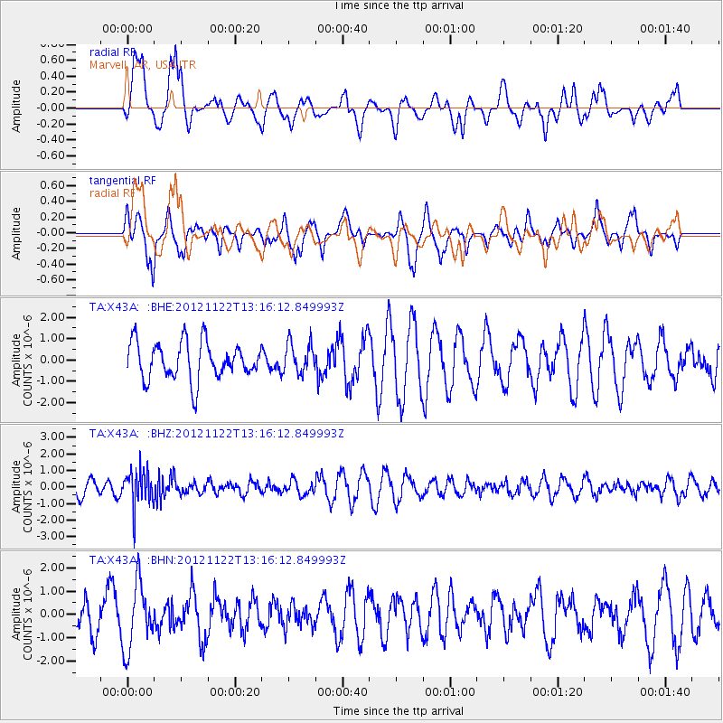
X43A Marvell, AR, USA - Earthquake Result Viewer
*The percent match for this event was below the threshold and hence no stack was calculated.
| Earthquake location: |
Salta Province, Argentina |
| Earthquake latitude/longitude: |
-22.7/-63.6 |
| Earthquake time(UTC): |
2012/11/22 (327) 13:07:10 GMT |
| Earthquake Depth: |
517 km |
| Earthquake Magnitude: |
5.6 MB, 5.9 MW, 6.0 MW |
| Earthquake Catalog/Contributor: |
WHDF/NEIC |
|
| Network: |
TA USArray Transportable Network (new EarthScope stations) |
| Station: |
X43A Marvell, AR, USA |
| Lat/Lon: |
34.52 N/90.88 W |
| Elevation: |
53 m |
|
| Distance: |
62.6 deg |
| Az: |
334.736 deg |
| Baz: |
151.5 deg |
| Ray Param: |
$rayparam |
*The percent match for this event was below the threshold and hence was not used in the summary stack. |
|
| Radial Match: |
41.522755 % |
| Radial Bump: |
400 |
| Transverse Match: |
52.80284 % |
| Transverse Bump: |
400 |
| SOD ConfigId: |
486959 |
| Insert Time: |
2013-03-21 20:09:23.142 +0000 |
| GWidth: |
2.5 |
| Max Bumps: |
400 |
| Tol: |
0.001 |
|
Signal To Noise
| Channel | StoN | STA | LTA |
| TA:X43A: :BHZ:20121122T13:16:12.849993Z | 2.5008004 | 1.0626123E-6 | 4.2490888E-7 |
| TA:X43A: :BHN:20121122T13:16:12.849993Z | 1.1798029 | 1.4243388E-6 | 1.2072686E-6 |
| TA:X43A: :BHE:20121122T13:16:12.849993Z | 0.80484366 | 6.99092E-7 | 8.686059E-7 |
| Arrivals |
| Ps | |
| PpPs | |
| PsPs/PpSs | |


