You are here: Home > Network List > TA - USArray Transportable Network (new EarthScope stations) Stations List
> Station P42A Winchester, IL, USA > Earthquake Result Viewer
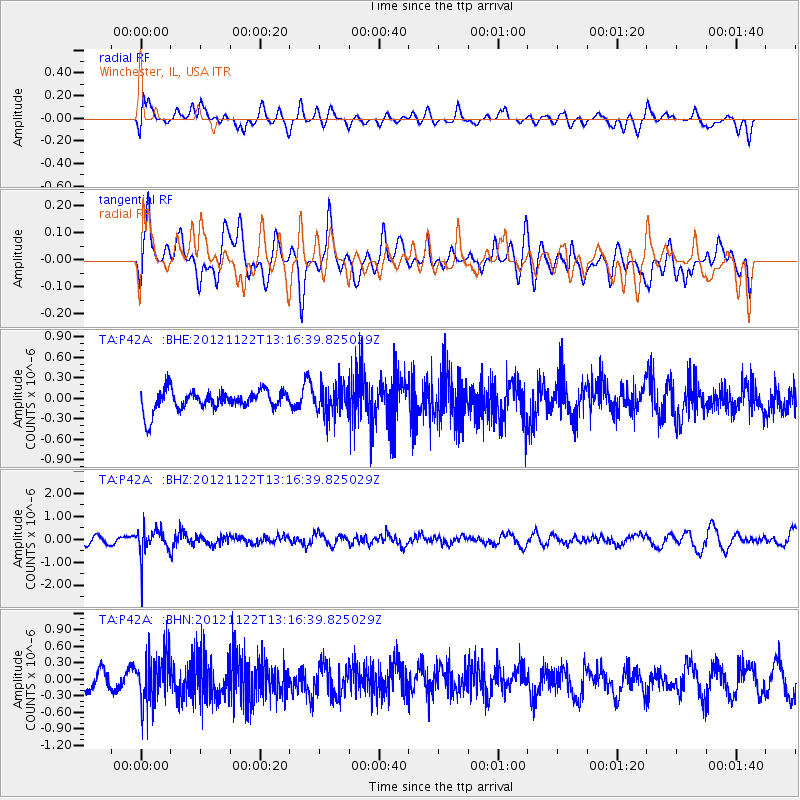
P42A Winchester, IL, USA - Earthquake Result Viewer
*The percent match for this event was below the threshold and hence no stack was calculated.
| Earthquake location: |
Salta Province, Argentina |
| Earthquake latitude/longitude: |
-22.7/-63.6 |
| Earthquake time(UTC): |
2012/11/22 (327) 13:07:10 GMT |
| Earthquake Depth: |
517 km |
| Earthquake Magnitude: |
5.6 MB, 5.9 MW, 6.0 MW |
| Earthquake Catalog/Contributor: |
WHDF/NEIC |
|
| Network: |
TA USArray Transportable Network (new EarthScope stations) |
| Station: |
P42A Winchester, IL, USA |
| Lat/Lon: |
39.59 N/90.34 W |
| Elevation: |
197 m |
|
| Distance: |
66.9 deg |
| Az: |
337.756 deg |
| Baz: |
153.113 deg |
| Ray Param: |
$rayparam |
*The percent match for this event was below the threshold and hence was not used in the summary stack. |
|
| Radial Match: |
50.430164 % |
| Radial Bump: |
400 |
| Transverse Match: |
51.69555 % |
| Transverse Bump: |
400 |
| SOD ConfigId: |
486959 |
| Insert Time: |
2013-03-21 20:10:45.853 +0000 |
| GWidth: |
2.5 |
| Max Bumps: |
400 |
| Tol: |
0.001 |
|
Signal To Noise
| Channel | StoN | STA | LTA |
| TA:P42A: :BHZ:20121122T13:16:39.825029Z | 1.7569343 | 6.222311E-7 | 3.541573E-7 |
| TA:P42A: :BHN:20121122T13:16:39.825029Z | 2.1778603 | 4.5059159E-7 | 2.0689647E-7 |
| TA:P42A: :BHE:20121122T13:16:39.825029Z | 1.4507701 | 2.162388E-7 | 1.4905105E-7 |
| Arrivals |
| Ps | |
| PpPs | |
| PsPs/PpSs | |


