You are here: Home > Network List > TA - USArray Transportable Network (new EarthScope stations) Stations List
> Station U41A Viola, AR, USA > Earthquake Result Viewer
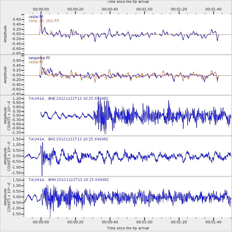
U41A Viola, AR, USA - Earthquake Result Viewer
*The percent match for this event was below the threshold and hence no stack was calculated.
| Earthquake location: |
Salta Province, Argentina |
| Earthquake latitude/longitude: |
-22.7/-63.6 |
| Earthquake time(UTC): |
2012/11/22 (327) 13:07:10 GMT |
| Earthquake Depth: |
517 km |
| Earthquake Magnitude: |
5.6 MB, 5.9 MW, 6.0 MW |
| Earthquake Catalog/Contributor: |
WHDF/NEIC |
|
| Network: |
TA USArray Transportable Network (new EarthScope stations) |
| Station: |
U41A Viola, AR, USA |
| Lat/Lon: |
36.34 N/91.92 W |
| Elevation: |
300 m |
|
| Distance: |
64.6 deg |
| Az: |
334.884 deg |
| Baz: |
150.966 deg |
| Ray Param: |
$rayparam |
*The percent match for this event was below the threshold and hence was not used in the summary stack. |
|
| Radial Match: |
54.272903 % |
| Radial Bump: |
400 |
| Transverse Match: |
64.727455 % |
| Transverse Bump: |
400 |
| SOD ConfigId: |
486959 |
| Insert Time: |
2013-03-21 20:11:04.310 +0000 |
| GWidth: |
2.5 |
| Max Bumps: |
400 |
| Tol: |
0.001 |
|
Signal To Noise
| Channel | StoN | STA | LTA |
| TA:U41A: :BHZ:20121122T13:16:25.64998Z | 3.2847958 | 5.239506E-7 | 1.595078E-7 |
| TA:U41A: :BHN:20121122T13:16:25.64998Z | 1.8221148 | 4.6020276E-7 | 2.5256517E-7 |
| TA:U41A: :BHE:20121122T13:16:25.64998Z | 3.6179442 | 4.5837544E-7 | 1.26695E-7 |
| Arrivals |
| Ps | |
| PpPs | |
| PsPs/PpSs | |


