You are here: Home > Network List > TA - USArray Transportable Network (new EarthScope stations) Stations List
> Station Z49A Columbiana, AL, USA > Earthquake Result Viewer
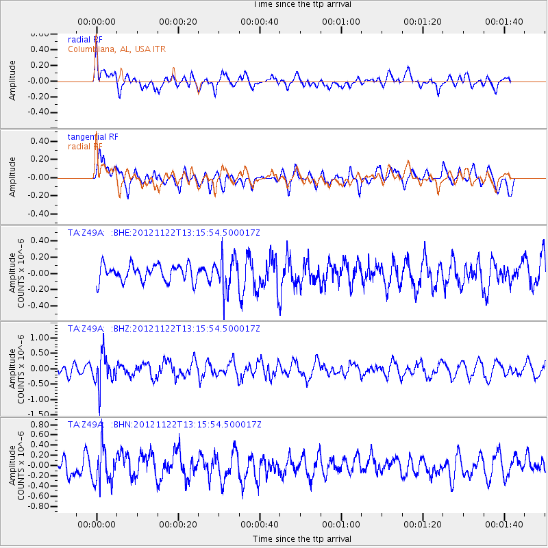
Z49A Columbiana, AL, USA - Earthquake Result Viewer
*The percent match for this event was below the threshold and hence no stack was calculated.
| Earthquake location: |
Salta Province, Argentina |
| Earthquake latitude/longitude: |
-22.7/-63.6 |
| Earthquake time(UTC): |
2012/11/22 (327) 13:07:10 GMT |
| Earthquake Depth: |
517 km |
| Earthquake Magnitude: |
5.6 MB, 5.9 MW, 6.0 MW |
| Earthquake Catalog/Contributor: |
WHDF/NEIC |
|
| Network: |
TA USArray Transportable Network (new EarthScope stations) |
| Station: |
Z49A Columbiana, AL, USA |
| Lat/Lon: |
33.19 N/86.53 W |
| Elevation: |
134 m |
|
| Distance: |
59.8 deg |
| Az: |
337.757 deg |
| Baz: |
155.37 deg |
| Ray Param: |
$rayparam |
*The percent match for this event was below the threshold and hence was not used in the summary stack. |
|
| Radial Match: |
49.654762 % |
| Radial Bump: |
400 |
| Transverse Match: |
65.067055 % |
| Transverse Bump: |
400 |
| SOD ConfigId: |
486959 |
| Insert Time: |
2013-03-21 20:17:37.105 +0000 |
| GWidth: |
2.5 |
| Max Bumps: |
400 |
| Tol: |
0.001 |
|
Signal To Noise
| Channel | StoN | STA | LTA |
| TA:Z49A: :BHZ:20121122T13:15:54.500017Z | 3.0129802 | 5.0981106E-7 | 1.6920491E-7 |
| TA:Z49A: :BHN:20121122T13:15:54.500017Z | 1.7036722 | 3.5131998E-7 | 2.0621337E-7 |
| TA:Z49A: :BHE:20121122T13:15:54.500017Z | 2.046778 | 2.0528356E-7 | 1.0029595E-7 |
| Arrivals |
| Ps | |
| PpPs | |
| PsPs/PpSs | |


