You are here: Home > Network List > TA - USArray Transportable Network (new EarthScope stations) Stations List
> Station N48A Decatur, IN, USA > Earthquake Result Viewer
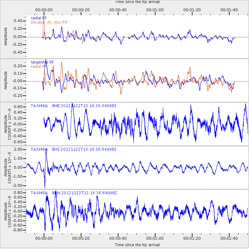
N48A Decatur, IN, USA - Earthquake Result Viewer
*The percent match for this event was below the threshold and hence no stack was calculated.
| Earthquake location: |
Salta Province, Argentina |
| Earthquake latitude/longitude: |
-22.7/-63.6 |
| Earthquake time(UTC): |
2012/11/22 (327) 13:07:10 GMT |
| Earthquake Depth: |
517 km |
| Earthquake Magnitude: |
5.6 MB, 5.9 MW, 6.0 MW |
| Earthquake Catalog/Contributor: |
WHDF/NEIC |
|
| Network: |
TA USArray Transportable Network (new EarthScope stations) |
| Station: |
N48A Decatur, IN, USA |
| Lat/Lon: |
40.86 N/85.03 W |
| Elevation: |
250 m |
|
| Distance: |
66.3 deg |
| Az: |
342.369 deg |
| Baz: |
158.367 deg |
| Ray Param: |
$rayparam |
*The percent match for this event was below the threshold and hence was not used in the summary stack. |
|
| Radial Match: |
53.51446 % |
| Radial Bump: |
400 |
| Transverse Match: |
51.867397 % |
| Transverse Bump: |
400 |
| SOD ConfigId: |
486959 |
| Insert Time: |
2013-03-21 20:25:37.112 +0000 |
| GWidth: |
2.5 |
| Max Bumps: |
400 |
| Tol: |
0.001 |
|
Signal To Noise
| Channel | StoN | STA | LTA |
| TA:N48A: :BHZ:20121122T13:16:36.64998Z | 3.0800939 | 8.148344E-7 | 2.6454856E-7 |
| TA:N48A: :BHN:20121122T13:16:36.64998Z | 2.2507606 | 4.3860064E-7 | 1.9486775E-7 |
| TA:N48A: :BHE:20121122T13:16:36.64998Z | 0.73215634 | 1.8088731E-7 | 2.4706102E-7 |
| Arrivals |
| Ps | |
| PpPs | |
| PsPs/PpSs | |


