
DPC Dobruska, Czech Republic - Earthquake Result Viewer
| ||||||||||||||||||
| ||||||||||||||||||
| ||||||||||||||||||
|
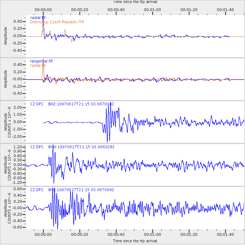
Signal To Noise
| Channel | StoN | STA | LTA |
| CZ:DPC: :BHN:19970617T21:15:03.066028Z | 7.18527 | 2.7502355E-7 | 3.8276024E-8 |
| CZ:DPC: :BHE:19970617T21:15:03.067004Z | 1.8485019 | 9.022205E-8 | 4.8808197E-8 |
| CZ:DPC: :BHZ:19970617T21:15:03.067004Z | 11.074462 | 6.614919E-7 | 5.973129E-8 |
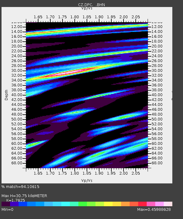
| Arrivals | |
| Ps | 3.9 SECOND |
| PpPs | 13 SECOND |
| PsPs/PpSs | 17 SECOND |

