You are here: Home > Network List > AZ - ANZA Regional Network Stations List
> Station SMER AZ.SMER > Earthquake Result Viewer
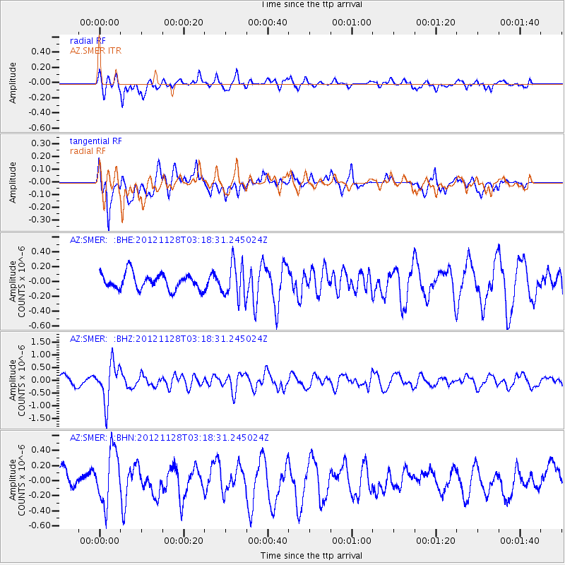
SMER AZ.SMER - Earthquake Result Viewer
*The percent match for this event was below the threshold and hence no stack was calculated.
| Earthquake location: |
Northern Peru |
| Earthquake latitude/longitude: |
-4.5/-76.1 |
| Earthquake time(UTC): |
2012/11/28 (333) 03:09:48 GMT |
| Earthquake Depth: |
118 km |
| Earthquake Magnitude: |
5.9 MB, 5.6 MW, 5.7 MW |
| Earthquake Catalog/Contributor: |
WHDF/NEIC |
|
| Network: |
AZ ANZA Regional Network |
| Station: |
SMER AZ.SMER |
| Lat/Lon: |
33.46 N/117.17 W |
| Elevation: |
355 m |
|
| Distance: |
54.2 deg |
| Az: |
317.359 deg |
| Baz: |
126.117 deg |
| Ray Param: |
$rayparam |
*The percent match for this event was below the threshold and hence was not used in the summary stack. |
|
| Radial Match: |
51.88716 % |
| Radial Bump: |
400 |
| Transverse Match: |
61.599247 % |
| Transverse Bump: |
400 |
| SOD ConfigId: |
486959 |
| Insert Time: |
2013-03-23 04:15:31.317 +0000 |
| GWidth: |
2.5 |
| Max Bumps: |
400 |
| Tol: |
0.001 |
|
Signal To Noise
| Channel | StoN | STA | LTA |
| AZ:SMER: :BHZ:20121128T03:18:31.245024Z | 2.5764391 | 7.667306E-7 | 2.9759312E-7 |
| AZ:SMER: :BHN:20121128T03:18:31.245024Z | 2.815447 | 3.6586297E-7 | 1.2994845E-7 |
| AZ:SMER: :BHE:20121128T03:18:31.245024Z | 2.2670696 | 2.3746945E-7 | 1.04747315E-7 |
| Arrivals |
| Ps | |
| PpPs | |
| PsPs/PpSs | |


