You are here: Home > Network List > CI - Caltech Regional Seismic Network Stations List
> Station GSC Goldstone, Goldstone Lake, CA, USA > Earthquake Result Viewer
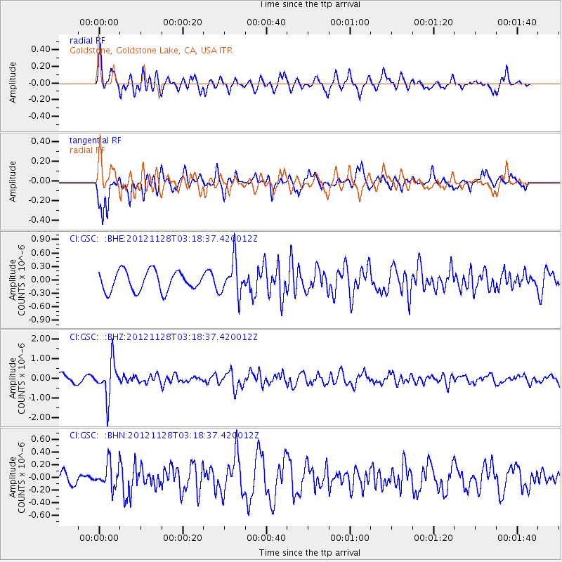
GSC Goldstone, Goldstone Lake, CA, USA - Earthquake Result Viewer
*The percent match for this event was below the threshold and hence no stack was calculated.
| Earthquake location: |
Northern Peru |
| Earthquake latitude/longitude: |
-4.5/-76.1 |
| Earthquake time(UTC): |
2012/11/28 (333) 03:09:48 GMT |
| Earthquake Depth: |
118 km |
| Earthquake Magnitude: |
5.9 MB, 5.6 MW, 5.7 MW |
| Earthquake Catalog/Contributor: |
WHDF/NEIC |
|
| Network: |
CI Caltech Regional Seismic Network |
| Station: |
GSC Goldstone, Goldstone Lake, CA, USA |
| Lat/Lon: |
35.30 N/116.81 W |
| Elevation: |
1000 m |
|
| Distance: |
55.0 deg |
| Az: |
319.388 deg |
| Baz: |
127.498 deg |
| Ray Param: |
$rayparam |
*The percent match for this event was below the threshold and hence was not used in the summary stack. |
|
| Radial Match: |
75.828384 % |
| Radial Bump: |
400 |
| Transverse Match: |
75.83709 % |
| Transverse Bump: |
400 |
| SOD ConfigId: |
486959 |
| Insert Time: |
2013-03-23 04:17:32.607 +0000 |
| GWidth: |
2.5 |
| Max Bumps: |
400 |
| Tol: |
0.001 |
|
Signal To Noise
| Channel | StoN | STA | LTA |
| CI:GSC: :BHZ:20121128T03:18:37.420012Z | 3.042578 | 9.17276E-7 | 3.0147987E-7 |
| CI:GSC: :BHN:20121128T03:18:37.420012Z | 1.0685717 | 2.0135371E-7 | 1.8843257E-7 |
| CI:GSC: :BHE:20121128T03:18:37.420012Z | 1.7916936 | 3.9210863E-7 | 2.1884803E-7 |
| Arrivals |
| Ps | |
| PpPs | |
| PsPs/PpSs | |


