You are here: Home > Network List > CI - Caltech Regional Seismic Network Stations List
> Station DGR Domenigoni Reservoir, California, USA > Earthquake Result Viewer
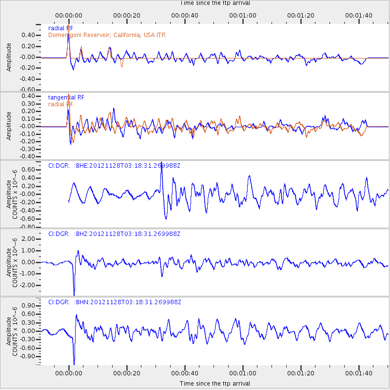
DGR Domenigoni Reservoir, California, USA - Earthquake Result Viewer
*The percent match for this event was below the threshold and hence no stack was calculated.
| Earthquake location: |
Northern Peru |
| Earthquake latitude/longitude: |
-4.5/-76.1 |
| Earthquake time(UTC): |
2012/11/28 (333) 03:09:48 GMT |
| Earthquake Depth: |
118 km |
| Earthquake Magnitude: |
5.9 MB, 5.6 MW, 5.7 MW |
| Earthquake Catalog/Contributor: |
WHDF/NEIC |
|
| Network: |
CI Caltech Regional Seismic Network |
| Station: |
DGR Domenigoni Reservoir, California, USA |
| Lat/Lon: |
33.65 N/117.01 W |
| Elevation: |
609 m |
|
| Distance: |
54.2 deg |
| Az: |
317.648 deg |
| Baz: |
126.375 deg |
| Ray Param: |
$rayparam |
*The percent match for this event was below the threshold and hence was not used in the summary stack. |
|
| Radial Match: |
68.425285 % |
| Radial Bump: |
400 |
| Transverse Match: |
72.2075 % |
| Transverse Bump: |
400 |
| SOD ConfigId: |
486959 |
| Insert Time: |
2013-03-23 04:18:24.150 +0000 |
| GWidth: |
2.5 |
| Max Bumps: |
400 |
| Tol: |
0.001 |
|
Signal To Noise
| Channel | StoN | STA | LTA |
| CI:DGR: :BHZ:20121128T03:18:31.269988Z | 5.5702157 | 8.390129E-7 | 1.5062486E-7 |
| CI:DGR: :BHN:20121128T03:18:31.269988Z | 3.5722194 | 4.013701E-7 | 1.1235875E-7 |
| CI:DGR: :BHE:20121128T03:18:31.269988Z | 2.8153908 | 3.1917654E-7 | 1.1336847E-7 |
| Arrivals |
| Ps | |
| PpPs | |
| PsPs/PpSs | |


