You are here: Home > Network List > CI - Caltech Regional Seismic Network Stations List
> Station FUR Furnace Creek, CA, USA > Earthquake Result Viewer
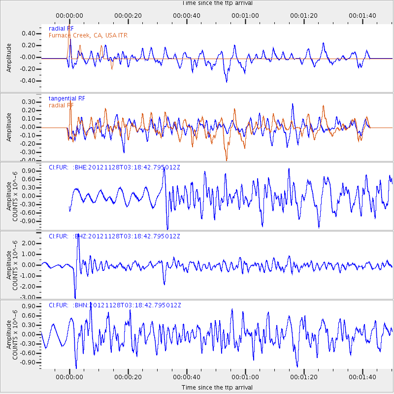
FUR Furnace Creek, CA, USA - Earthquake Result Viewer
*The percent match for this event was below the threshold and hence no stack was calculated.
| Earthquake location: |
Northern Peru |
| Earthquake latitude/longitude: |
-4.5/-76.1 |
| Earthquake time(UTC): |
2012/11/28 (333) 03:09:48 GMT |
| Earthquake Depth: |
118 km |
| Earthquake Magnitude: |
5.9 MB, 5.6 MW, 5.7 MW |
| Earthquake Catalog/Contributor: |
WHDF/NEIC |
|
| Network: |
CI Caltech Regional Seismic Network |
| Station: |
FUR Furnace Creek, CA, USA |
| Lat/Lon: |
36.47 N/116.86 W |
| Elevation: |
-37.0 m |
|
| Distance: |
55.8 deg |
| Az: |
320.469 deg |
| Baz: |
128.078 deg |
| Ray Param: |
$rayparam |
*The percent match for this event was below the threshold and hence was not used in the summary stack. |
|
| Radial Match: |
61.39292 % |
| Radial Bump: |
400 |
| Transverse Match: |
70.271255 % |
| Transverse Bump: |
400 |
| SOD ConfigId: |
486959 |
| Insert Time: |
2013-03-23 04:18:37.183 +0000 |
| GWidth: |
2.5 |
| Max Bumps: |
400 |
| Tol: |
0.001 |
|
Signal To Noise
| Channel | StoN | STA | LTA |
| CI:FUR: :BHZ:20121128T03:18:42.795012Z | 6.285817 | 1.2641694E-6 | 2.0111456E-7 |
| CI:FUR: :BHN:20121128T03:18:42.795012Z | 2.0766504 | 4.4769916E-7 | 2.1558716E-7 |
| CI:FUR: :BHE:20121128T03:18:42.795012Z | 3.0355742 | 5.361918E-7 | 1.7663602E-7 |
| Arrivals |
| Ps | |
| PpPs | |
| PsPs/PpSs | |


