You are here: Home > Network List > TA - USArray Transportable Network (new EarthScope stations) Stations List
> Station T44A Benton, MO, USA > Earthquake Result Viewer
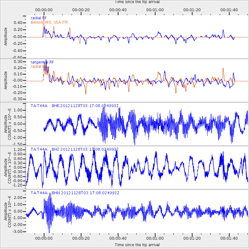
T44A Benton, MO, USA - Earthquake Result Viewer
*The percent match for this event was below the threshold and hence no stack was calculated.
| Earthquake location: |
Northern Peru |
| Earthquake latitude/longitude: |
-4.5/-76.1 |
| Earthquake time(UTC): |
2012/11/28 (333) 03:09:48 GMT |
| Earthquake Depth: |
118 km |
| Earthquake Magnitude: |
5.9 MB, 5.6 MW, 5.7 MW |
| Earthquake Catalog/Contributor: |
WHDF/NEIC |
|
| Network: |
TA USArray Transportable Network (new EarthScope stations) |
| Station: |
T44A Benton, MO, USA |
| Lat/Lon: |
37.09 N/89.59 W |
| Elevation: |
133 m |
|
| Distance: |
43.3 deg |
| Az: |
344.207 deg |
| Baz: |
160.166 deg |
| Ray Param: |
$rayparam |
*The percent match for this event was below the threshold and hence was not used in the summary stack. |
|
| Radial Match: |
62.343018 % |
| Radial Bump: |
400 |
| Transverse Match: |
71.49177 % |
| Transverse Bump: |
400 |
| SOD ConfigId: |
486959 |
| Insert Time: |
2013-03-23 04:39:48.762 +0000 |
| GWidth: |
2.5 |
| Max Bumps: |
400 |
| Tol: |
0.001 |
|
Signal To Noise
| Channel | StoN | STA | LTA |
| TA:T44A: :BHZ:20121128T03:17:08.024993Z | 1.2562795 | 6.4029445E-7 | 5.0967515E-7 |
| TA:T44A: :BHN:20121128T03:17:08.024993Z | 4.015741 | 1.3689961E-6 | 3.4090746E-7 |
| TA:T44A: :BHE:20121128T03:17:08.024993Z | 1.9214183 | 6.3755084E-7 | 3.318126E-7 |
| Arrivals |
| Ps | |
| PpPs | |
| PsPs/PpSs | |


