You are here: Home > Network List > TA - USArray Transportable Network (new EarthScope stations) Stations List
> Station G43A Wallace, MI, USA > Earthquake Result Viewer
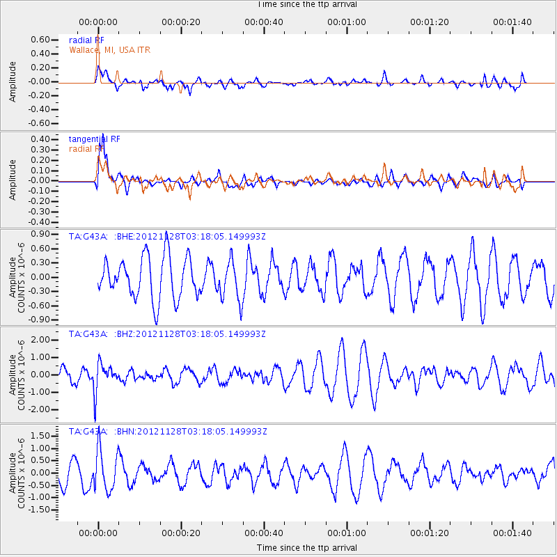
G43A Wallace, MI, USA - Earthquake Result Viewer
*The percent match for this event was below the threshold and hence no stack was calculated.
| Earthquake location: |
Northern Peru |
| Earthquake latitude/longitude: |
-4.5/-76.1 |
| Earthquake time(UTC): |
2012/11/28 (333) 03:09:48 GMT |
| Earthquake Depth: |
118 km |
| Earthquake Magnitude: |
5.9 MB, 5.6 MW, 5.7 MW |
| Earthquake Catalog/Contributor: |
WHDF/NEIC |
|
| Network: |
TA USArray Transportable Network (new EarthScope stations) |
| Station: |
G43A Wallace, MI, USA |
| Lat/Lon: |
45.26 N/87.69 W |
| Elevation: |
213 m |
|
| Distance: |
50.6 deg |
| Az: |
349.427 deg |
| Baz: |
164.99 deg |
| Ray Param: |
$rayparam |
*The percent match for this event was below the threshold and hence was not used in the summary stack. |
|
| Radial Match: |
42.9452 % |
| Radial Bump: |
400 |
| Transverse Match: |
64.78243 % |
| Transverse Bump: |
400 |
| SOD ConfigId: |
486959 |
| Insert Time: |
2013-03-23 04:42:13.324 +0000 |
| GWidth: |
2.5 |
| Max Bumps: |
400 |
| Tol: |
0.001 |
|
Signal To Noise
| Channel | StoN | STA | LTA |
| TA:G43A: :BHZ:20121128T03:18:05.149993Z | 2.244413 | 8.459972E-7 | 3.7693474E-7 |
| TA:G43A: :BHN:20121128T03:18:05.149993Z | 2.7044718 | 8.555863E-7 | 3.1635983E-7 |
| TA:G43A: :BHE:20121128T03:18:05.149993Z | 0.98004115 | 4.2638143E-7 | 4.3506483E-7 |
| Arrivals |
| Ps | |
| PpPs | |
| PsPs/PpSs | |


