You are here: Home > Network List > TA - USArray Transportable Network (new EarthScope stations) Stations List
> Station T47A Sharon Grove, KY, USA > Earthquake Result Viewer
T47A Sharon Grove, KY, USA - Earthquake Result Viewer
*The percent match for this event was below the threshold and hence no stack was calculated.
| Earthquake location: |
Northern Peru |
| Earthquake latitude/longitude: |
-4.5/-76.1 |
| Earthquake time(UTC): |
2012/11/28 (333) 03:09:48 GMT |
| Earthquake Depth: |
118 km |
| Earthquake Magnitude: |
5.9 MB, 5.6 MW, 5.7 MW |
| Earthquake Catalog/Contributor: |
WHDF/NEIC |
|
| Network: |
TA USArray Transportable Network (new EarthScope stations) |
| Station: |
T47A Sharon Grove, KY, USA |
| Lat/Lon: |
36.99 N/87.11 W |
| Elevation: |
217 m |
|
| Distance: |
42.6 deg |
| Az: |
346.938 deg |
| Baz: |
163.657 deg |
| Ray Param: |
$rayparam |
*The percent match for this event was below the threshold and hence was not used in the summary stack. |
|
| Radial Match: |
67.9117 % |
| Radial Bump: |
400 |
| Transverse Match: |
68.13764 % |
| Transverse Bump: |
400 |
| SOD ConfigId: |
486959 |
| Insert Time: |
2013-03-23 04:44:27.521 +0000 |
| GWidth: |
2.5 |
| Max Bumps: |
400 |
| Tol: |
0.001 |
|
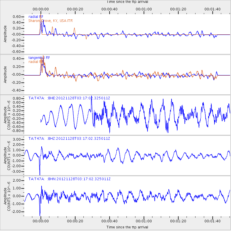
Signal To Noise
| Channel | StoN | STA | LTA |
| TA:T47A: :BHZ:20121128T03:17:02.325011Z | 1.8891324 | 9.870157E-7 | 5.224704E-7 |
| TA:T47A: :BHN:20121128T03:17:02.325011Z | 2.3470633 | 7.2029184E-7 | 3.0689068E-7 |
| TA:T47A: :BHE:20121128T03:17:02.325011Z | 0.90726024 | 3.111006E-7 | 3.429012E-7 |
| Arrivals |
| Ps | |
| PpPs | |
| PsPs/PpSs | |


