You are here: Home > Network List > TA - USArray Transportable Network (new EarthScope stations) Stations List
> Station 455A Stateville, GA, USA > Earthquake Result Viewer
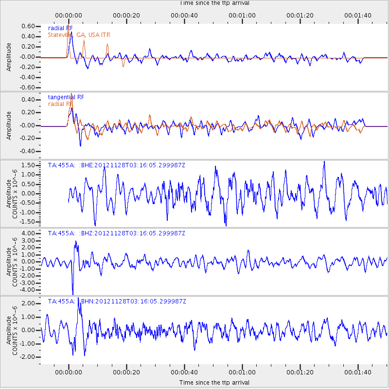
455A Stateville, GA, USA - Earthquake Result Viewer
*The percent match for this event was below the threshold and hence no stack was calculated.
| Earthquake location: |
Northern Peru |
| Earthquake latitude/longitude: |
-4.5/-76.1 |
| Earthquake time(UTC): |
2012/11/28 (333) 03:09:48 GMT |
| Earthquake Depth: |
118 km |
| Earthquake Magnitude: |
5.9 MB, 5.6 MW, 5.7 MW |
| Earthquake Catalog/Contributor: |
WHDF/NEIC |
|
| Network: |
TA USArray Transportable Network (new EarthScope stations) |
| Station: |
455A Stateville, GA, USA |
| Lat/Lon: |
30.74 N/83.03 W |
| Elevation: |
44 m |
|
| Distance: |
35.7 deg |
| Az: |
349.749 deg |
| Baz: |
168.109 deg |
| Ray Param: |
$rayparam |
*The percent match for this event was below the threshold and hence was not used in the summary stack. |
|
| Radial Match: |
56.70091 % |
| Radial Bump: |
400 |
| Transverse Match: |
68.50342 % |
| Transverse Bump: |
400 |
| SOD ConfigId: |
486959 |
| Insert Time: |
2013-03-23 04:52:10.499 +0000 |
| GWidth: |
2.5 |
| Max Bumps: |
400 |
| Tol: |
0.001 |
|
Signal To Noise
| Channel | StoN | STA | LTA |
| TA:455A: :BHZ:20121128T03:16:05.299987Z | 3.12153 | 1.7384269E-6 | 5.56915E-7 |
| TA:455A: :BHN:20121128T03:16:05.299987Z | 2.8201268 | 1.1371322E-6 | 4.0322024E-7 |
| TA:455A: :BHE:20121128T03:16:05.299987Z | 0.79930633 | 4.6081198E-7 | 5.765148E-7 |
| Arrivals |
| Ps | |
| PpPs | |
| PsPs/PpSs | |


