You are here: Home > Network List > TA - USArray Transportable Network (new EarthScope stations) Stations List
> Station V52A Sevierville, TN, USA > Earthquake Result Viewer
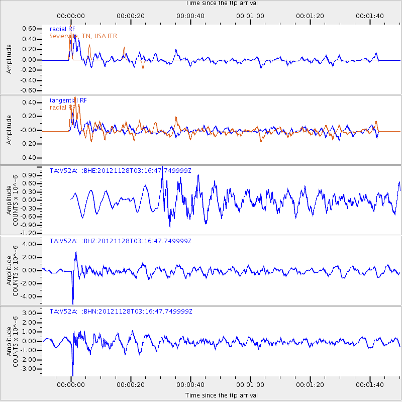
V52A Sevierville, TN, USA - Earthquake Result Viewer
*The percent match for this event was below the threshold and hence no stack was calculated.
| Earthquake location: |
Northern Peru |
| Earthquake latitude/longitude: |
-4.5/-76.1 |
| Earthquake time(UTC): |
2012/11/28 (333) 03:09:48 GMT |
| Earthquake Depth: |
118 km |
| Earthquake Magnitude: |
5.9 MB, 5.6 MW, 5.7 MW |
| Earthquake Catalog/Contributor: |
WHDF/NEIC |
|
| Network: |
TA USArray Transportable Network (new EarthScope stations) |
| Station: |
V52A Sevierville, TN, USA |
| Lat/Lon: |
35.84 N/83.60 W |
| Elevation: |
328 m |
|
| Distance: |
40.8 deg |
| Az: |
350.659 deg |
| Baz: |
168.512 deg |
| Ray Param: |
$rayparam |
*The percent match for this event was below the threshold and hence was not used in the summary stack. |
|
| Radial Match: |
60.936436 % |
| Radial Bump: |
400 |
| Transverse Match: |
51.885414 % |
| Transverse Bump: |
400 |
| SOD ConfigId: |
486959 |
| Insert Time: |
2013-03-23 04:57:28.281 +0000 |
| GWidth: |
2.5 |
| Max Bumps: |
400 |
| Tol: |
0.001 |
|
Signal To Noise
| Channel | StoN | STA | LTA |
| TA:V52A: :BHZ:20121128T03:16:47.749999Z | 3.1636405 | 1.5043069E-6 | 4.7549867E-7 |
| TA:V52A: :BHN:20121128T03:16:47.749999Z | 2.2715685 | 9.782107E-7 | 4.306322E-7 |
| TA:V52A: :BHE:20121128T03:16:47.749999Z | 2.0209174 | 5.049502E-7 | 2.4986187E-7 |
| Arrivals |
| Ps | |
| PpPs | |
| PsPs/PpSs | |


