You are here: Home > Network List > TA - USArray Transportable Network (new EarthScope stations) Stations List
> Station M47A Cromwell, IN, USA > Earthquake Result Viewer
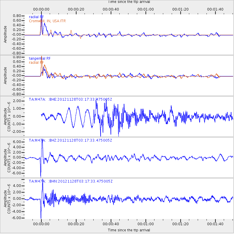
M47A Cromwell, IN, USA - Earthquake Result Viewer
*The percent match for this event was below the threshold and hence no stack was calculated.
| Earthquake location: |
Northern Peru |
| Earthquake latitude/longitude: |
-4.5/-76.1 |
| Earthquake time(UTC): |
2012/11/28 (333) 03:09:48 GMT |
| Earthquake Depth: |
118 km |
| Earthquake Magnitude: |
5.9 MB, 5.6 MW, 5.7 MW |
| Earthquake Catalog/Contributor: |
WHDF/NEIC |
|
| Network: |
TA USArray Transportable Network (new EarthScope stations) |
| Station: |
M47A Cromwell, IN, USA |
| Lat/Lon: |
41.36 N/85.62 W |
| Elevation: |
283 m |
|
| Distance: |
46.5 deg |
| Az: |
350.114 deg |
| Baz: |
166.857 deg |
| Ray Param: |
$rayparam |
*The percent match for this event was below the threshold and hence was not used in the summary stack. |
|
| Radial Match: |
64.92638 % |
| Radial Bump: |
400 |
| Transverse Match: |
70.45571 % |
| Transverse Bump: |
365 |
| SOD ConfigId: |
486959 |
| Insert Time: |
2013-03-23 05:01:36.794 +0000 |
| GWidth: |
2.5 |
| Max Bumps: |
400 |
| Tol: |
0.001 |
|
Signal To Noise
| Channel | StoN | STA | LTA |
| TA:M47A: :BHZ:20121128T03:17:33.475005Z | 5.378934 | 2.7576525E-6 | 5.1267637E-7 |
| TA:M47A: :BHN:20121128T03:17:33.475005Z | 3.9052217 | 2.1432593E-6 | 5.4881883E-7 |
| TA:M47A: :BHE:20121128T03:17:33.475005Z | 1.6995782 | 1.0796326E-6 | 6.352356E-7 |
| Arrivals |
| Ps | |
| PpPs | |
| PsPs/PpSs | |


