You are here: Home > Network List > NE - New England Seismic Network Stations List
> Station PQI Presque Isle, ME, USA > Earthquake Result Viewer
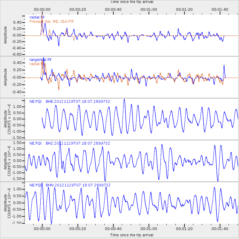
PQI Presque Isle, ME, USA - Earthquake Result Viewer
*The percent match for this event was below the threshold and hence no stack was calculated.
| Earthquake location: |
Near Coast Of Northern Peru |
| Earthquake latitude/longitude: |
-6.6/-81.1 |
| Earthquake time(UTC): |
2012/11/29 (334) 07:09:12 GMT |
| Earthquake Depth: |
10 km |
| Earthquake Magnitude: |
5.5 MB, 4.9 MS, 5.5 MW, 5.4 MW |
| Earthquake Catalog/Contributor: |
WHDF/NEIC |
|
| Network: |
NE New England Seismic Network |
| Station: |
PQI Presque Isle, ME, USA |
| Lat/Lon: |
46.67 N/68.02 W |
| Elevation: |
162 m |
|
| Distance: |
54.3 deg |
| Az: |
11.042 deg |
| Baz: |
196.041 deg |
| Ray Param: |
$rayparam |
*The percent match for this event was below the threshold and hence was not used in the summary stack. |
|
| Radial Match: |
46.830402 % |
| Radial Bump: |
400 |
| Transverse Match: |
56.874893 % |
| Transverse Bump: |
283 |
| SOD ConfigId: |
486959 |
| Insert Time: |
2013-03-23 05:20:02.573 +0000 |
| GWidth: |
2.5 |
| Max Bumps: |
400 |
| Tol: |
0.001 |
|
Signal To Noise
| Channel | StoN | STA | LTA |
| NE:PQI: :BHZ:20121129T07:18:07.289973Z | 0.6100666 | 3.581779E-7 | 5.871128E-7 |
| NE:PQI: :BHN:20121129T07:18:07.289973Z | 2.0944242 | 8.923546E-7 | 4.2606203E-7 |
| NE:PQI: :BHE:20121129T07:18:07.289973Z | 0.8731676 | 5.5509093E-7 | 6.3572094E-7 |
| Arrivals |
| Ps | |
| PpPs | |
| PsPs/PpSs | |


