You are here: Home > Network List > TA - USArray Transportable Network (new EarthScope stations) Stations List
> Station G43A Wallace, MI, USA > Earthquake Result Viewer
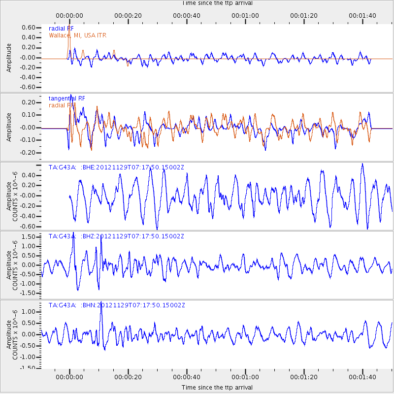
G43A Wallace, MI, USA - Earthquake Result Viewer
*The percent match for this event was below the threshold and hence no stack was calculated.
| Earthquake location: |
Near Coast Of Northern Peru |
| Earthquake latitude/longitude: |
-6.6/-81.1 |
| Earthquake time(UTC): |
2012/11/29 (334) 07:09:12 GMT |
| Earthquake Depth: |
10 km |
| Earthquake Magnitude: |
5.5 MB, 4.9 MS, 5.5 MW, 5.4 MW |
| Earthquake Catalog/Contributor: |
WHDF/NEIC |
|
| Network: |
TA USArray Transportable Network (new EarthScope stations) |
| Station: |
G43A Wallace, MI, USA |
| Lat/Lon: |
45.26 N/87.69 W |
| Elevation: |
213 m |
|
| Distance: |
51.9 deg |
| Az: |
354.068 deg |
| Baz: |
171.642 deg |
| Ray Param: |
$rayparam |
*The percent match for this event was below the threshold and hence was not used in the summary stack. |
|
| Radial Match: |
60.171284 % |
| Radial Bump: |
400 |
| Transverse Match: |
62.503628 % |
| Transverse Bump: |
400 |
| SOD ConfigId: |
486959 |
| Insert Time: |
2013-03-23 05:24:04.612 +0000 |
| GWidth: |
2.5 |
| Max Bumps: |
400 |
| Tol: |
0.001 |
|
Signal To Noise
| Channel | StoN | STA | LTA |
| TA:G43A: :BHZ:20121129T07:17:50.15002Z | 3.4064798 | 7.898081E-7 | 2.3185463E-7 |
| TA:G43A: :BHN:20121129T07:17:50.15002Z | 1.3409026 | 2.2747018E-7 | 1.696396E-7 |
| TA:G43A: :BHE:20121129T07:17:50.15002Z | 1.4506356 | 3.373343E-7 | 2.3254243E-7 |
| Arrivals |
| Ps | |
| PpPs | |
| PsPs/PpSs | |


