You are here: Home > Network List > TA - USArray Transportable Network (new EarthScope stations) Stations List
> Station V49A McMinnville, TN, USA > Earthquake Result Viewer
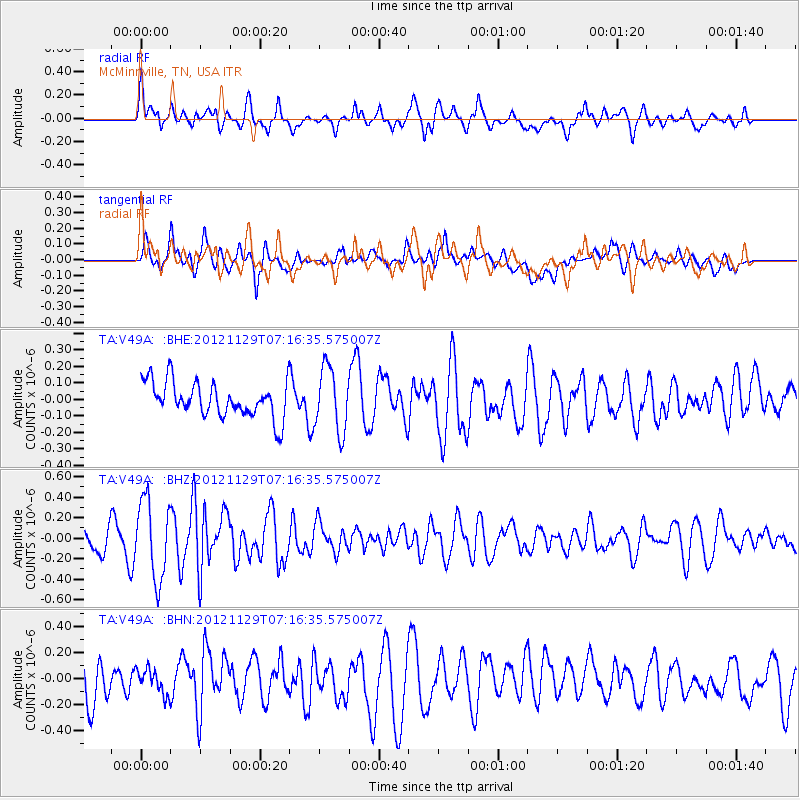
V49A McMinnville, TN, USA - Earthquake Result Viewer
*The percent match for this event was below the threshold and hence no stack was calculated.
| Earthquake location: |
Near Coast Of Northern Peru |
| Earthquake latitude/longitude: |
-6.6/-81.1 |
| Earthquake time(UTC): |
2012/11/29 (334) 07:09:12 GMT |
| Earthquake Depth: |
10 km |
| Earthquake Magnitude: |
5.5 MB, 4.9 MS, 5.5 MW, 5.4 MW |
| Earthquake Catalog/Contributor: |
WHDF/NEIC |
|
| Network: |
TA USArray Transportable Network (new EarthScope stations) |
| Station: |
V49A McMinnville, TN, USA |
| Lat/Lon: |
35.77 N/85.90 W |
| Elevation: |
329 m |
|
| Distance: |
42.4 deg |
| Az: |
354.165 deg |
| Baz: |
172.866 deg |
| Ray Param: |
$rayparam |
*The percent match for this event was below the threshold and hence was not used in the summary stack. |
|
| Radial Match: |
60.172977 % |
| Radial Bump: |
400 |
| Transverse Match: |
67.167366 % |
| Transverse Bump: |
400 |
| SOD ConfigId: |
486959 |
| Insert Time: |
2013-03-23 05:26:25.508 +0000 |
| GWidth: |
2.5 |
| Max Bumps: |
400 |
| Tol: |
0.001 |
|
Signal To Noise
| Channel | StoN | STA | LTA |
| TA:V49A: :BHZ:20121129T07:16:35.575007Z | 2.1299539 | 3.8282292E-7 | 1.7973296E-7 |
| TA:V49A: :BHN:20121129T07:16:35.575007Z | 0.59956735 | 9.444695E-8 | 1.5752516E-7 |
| TA:V49A: :BHE:20121129T07:16:35.575007Z | 1.8129426 | 1.927728E-7 | 1.0633145E-7 |
| Arrivals |
| Ps | |
| PpPs | |
| PsPs/PpSs | |


