You are here: Home > Network List > TA - USArray Transportable Network (new EarthScope stations) Stations List
> Station J01E Myrtle Point, OR, USA > Earthquake Result Viewer
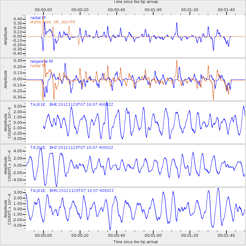
J01E Myrtle Point, OR, USA - Earthquake Result Viewer
*The percent match for this event was below the threshold and hence no stack was calculated.
| Earthquake location: |
Near Coast Of Northern Peru |
| Earthquake latitude/longitude: |
-6.6/-81.1 |
| Earthquake time(UTC): |
2012/11/29 (334) 07:09:12 GMT |
| Earthquake Depth: |
10 km |
| Earthquake Magnitude: |
5.5 MB, 4.9 MS, 5.5 MW, 5.4 MW |
| Earthquake Catalog/Contributor: |
WHDF/NEIC |
|
| Network: |
TA USArray Transportable Network (new EarthScope stations) |
| Station: |
J01E Myrtle Point, OR, USA |
| Lat/Lon: |
43.16 N/123.93 W |
| Elevation: |
128 m |
|
| Distance: |
62.9 deg |
| Az: |
326.014 deg |
| Baz: |
130.626 deg |
| Ray Param: |
$rayparam |
*The percent match for this event was below the threshold and hence was not used in the summary stack. |
|
| Radial Match: |
59.063725 % |
| Radial Bump: |
400 |
| Transverse Match: |
67.49062 % |
| Transverse Bump: |
321 |
| SOD ConfigId: |
486959 |
| Insert Time: |
2013-03-23 05:27:32.305 +0000 |
| GWidth: |
2.5 |
| Max Bumps: |
400 |
| Tol: |
0.001 |
|
Signal To Noise
| Channel | StoN | STA | LTA |
| TA:J01E: :BHZ:20121129T07:19:07.40002Z | 2.6967275 | 3.367987E-6 | 1.2489163E-6 |
| TA:J01E: :BHN:20121129T07:19:07.40002Z | 1.3319852 | 1.7076985E-6 | 1.2820702E-6 |
| TA:J01E: :BHE:20121129T07:19:07.40002Z | 1.618628 | 1.9075342E-6 | 1.1784883E-6 |
| Arrivals |
| Ps | |
| PpPs | |
| PsPs/PpSs | |


