You are here: Home > Network List > IC - New China Digital Seismograph Network Stations List
> Station ENH Enshi, Hubei Province, China > Earthquake Result Viewer
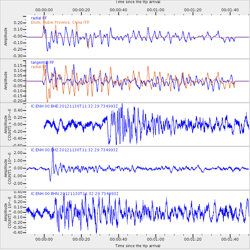
ENH Enshi, Hubei Province, China - Earthquake Result Viewer
*The percent match for this event was below the threshold and hence no stack was calculated.
| Earthquake location: |
Tonga Islands |
| Earthquake latitude/longitude: |
-18.8/-175.6 |
| Earthquake time(UTC): |
2012/11/30 (335) 11:20:38 GMT |
| Earthquake Depth: |
200 km |
| Earthquake Magnitude: |
5.7 MW, 5.1 MB, 5.7 MW |
| Earthquake Catalog/Contributor: |
WHDF/NEIC |
|
| Network: |
IC New China Digital Seismograph Network |
| Station: |
ENH Enshi, Hubei Province, China |
| Lat/Lon: |
30.28 N/109.49 E |
| Elevation: |
500 m |
|
| Distance: |
87.0 deg |
| Az: |
303.239 deg |
| Baz: |
113.684 deg |
| Ray Param: |
$rayparam |
*The percent match for this event was below the threshold and hence was not used in the summary stack. |
|
| Radial Match: |
73.681725 % |
| Radial Bump: |
400 |
| Transverse Match: |
71.86182 % |
| Transverse Bump: |
400 |
| SOD ConfigId: |
486959 |
| Insert Time: |
2013-03-23 05:42:47.913 +0000 |
| GWidth: |
2.5 |
| Max Bumps: |
400 |
| Tol: |
0.001 |
|
Signal To Noise
| Channel | StoN | STA | LTA |
| IC:ENH:00:BHZ:20121130T11:32:29.734993Z | 8.885404 | 8.786213E-7 | 9.888367E-8 |
| IC:ENH:00:BHN:20121130T11:32:29.734993Z | 0.865047 | 5.9793074E-8 | 6.9121185E-8 |
| IC:ENH:00:BHE:20121130T11:32:29.734993Z | 2.027384 | 1.6943133E-7 | 8.35714E-8 |
| Arrivals |
| Ps | |
| PpPs | |
| PsPs/PpSs | |


