You are here: Home > Network List > TA - USArray Transportable Network (new EarthScope stations) Stations List
> Station MDND Maddock, ND, USA > Earthquake Result Viewer
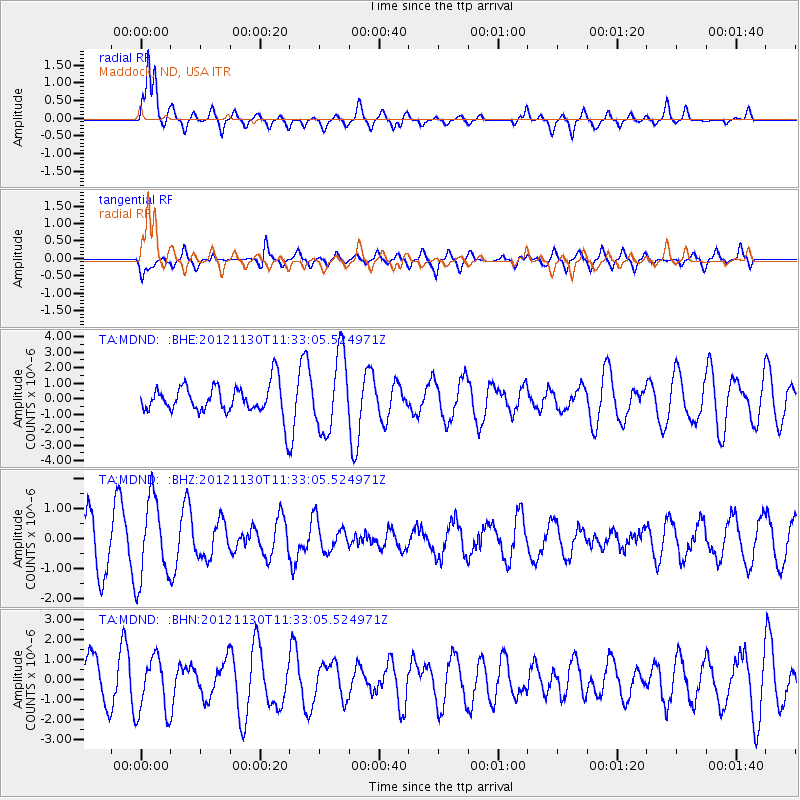
MDND Maddock, ND, USA - Earthquake Result Viewer
*The percent match for this event was below the threshold and hence no stack was calculated.
| Earthquake location: |
Tonga Islands |
| Earthquake latitude/longitude: |
-18.8/-175.6 |
| Earthquake time(UTC): |
2012/11/30 (335) 11:20:38 GMT |
| Earthquake Depth: |
200 km |
| Earthquake Magnitude: |
5.7 MW, 5.1 MB, 5.7 MW |
| Earthquake Catalog/Contributor: |
WHDF/NEIC |
|
| Network: |
TA USArray Transportable Network (new EarthScope stations) |
| Station: |
MDND Maddock, ND, USA |
| Lat/Lon: |
47.85 N/99.60 W |
| Elevation: |
479 m |
|
| Distance: |
94.7 deg |
| Az: |
40.979 deg |
| Baz: |
247.244 deg |
| Ray Param: |
$rayparam |
*The percent match for this event was below the threshold and hence was not used in the summary stack. |
|
| Radial Match: |
78.47463 % |
| Radial Bump: |
400 |
| Transverse Match: |
52.688583 % |
| Transverse Bump: |
400 |
| SOD ConfigId: |
486959 |
| Insert Time: |
2013-03-23 05:44:42.052 +0000 |
| GWidth: |
2.5 |
| Max Bumps: |
400 |
| Tol: |
0.001 |
|
Signal To Noise
| Channel | StoN | STA | LTA |
| TA:MDND: :BHZ:20121130T11:33:05.524971Z | 2.323493 | 1.3494149E-6 | 5.8076995E-7 |
| TA:MDND: :BHN:20121130T11:33:05.524971Z | 1.000145 | 1.4142522E-6 | 1.4140471E-6 |
| TA:MDND: :BHE:20121130T11:33:05.524971Z | 2.5011408 | 2.4479516E-6 | 9.787341E-7 |
| Arrivals |
| Ps | |
| PpPs | |
| PsPs/PpSs | |


