You are here: Home > Network List > TA - USArray Transportable Network (new EarthScope stations) Stations List
> Station KSCO Kaye Shedlock's, Cheyenne Wells, CO, USA > Earthquake Result Viewer
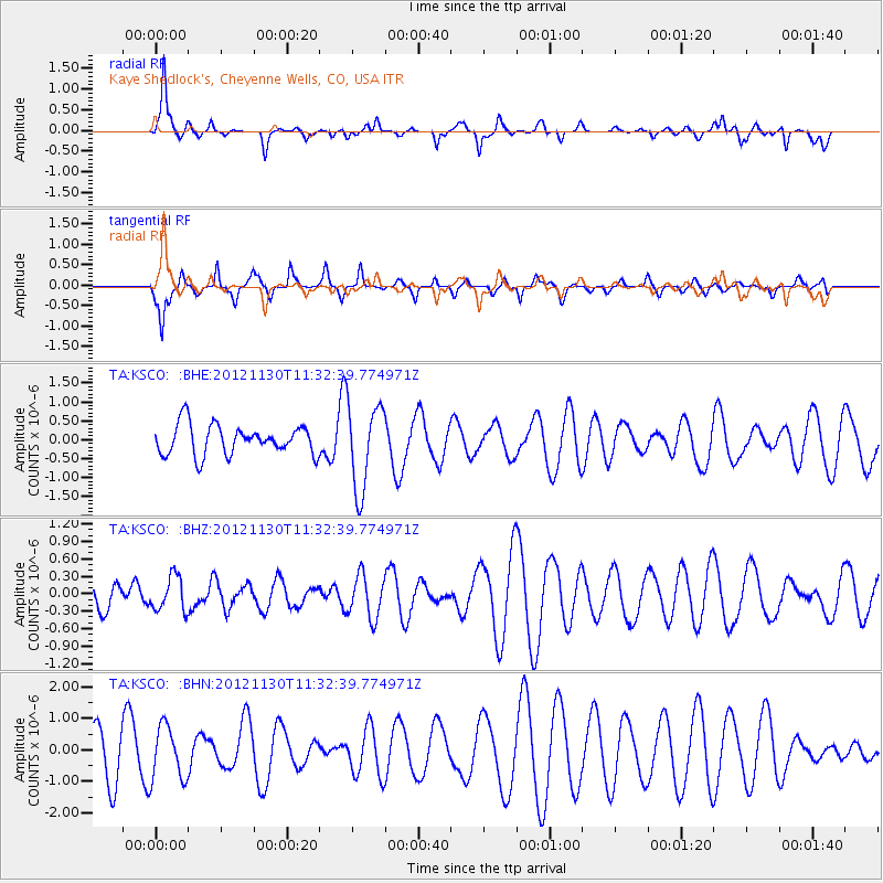
KSCO Kaye Shedlock's, Cheyenne Wells, CO, USA - Earthquake Result Viewer
*The percent match for this event was below the threshold and hence no stack was calculated.
| Earthquake location: |
Tonga Islands |
| Earthquake latitude/longitude: |
-18.8/-175.6 |
| Earthquake time(UTC): |
2012/11/30 (335) 11:20:38 GMT |
| Earthquake Depth: |
200 km |
| Earthquake Magnitude: |
5.7 MW, 5.1 MB, 5.7 MW |
| Earthquake Catalog/Contributor: |
WHDF/NEIC |
|
| Network: |
TA USArray Transportable Network (new EarthScope stations) |
| Station: |
KSCO Kaye Shedlock's, Cheyenne Wells, CO, USA |
| Lat/Lon: |
39.01 N/102.63 W |
| Elevation: |
1382 m |
|
| Distance: |
89.1 deg |
| Az: |
48.159 deg |
| Baz: |
244.922 deg |
| Ray Param: |
$rayparam |
*The percent match for this event was below the threshold and hence was not used in the summary stack. |
|
| Radial Match: |
87.348045 % |
| Radial Bump: |
354 |
| Transverse Match: |
65.31365 % |
| Transverse Bump: |
376 |
| SOD ConfigId: |
486959 |
| Insert Time: |
2013-03-23 05:44:53.145 +0000 |
| GWidth: |
2.5 |
| Max Bumps: |
400 |
| Tol: |
0.001 |
|
Signal To Noise
| Channel | StoN | STA | LTA |
| TA:KSCO: :BHZ:20121130T11:32:39.774971Z | 1.1108422 | 2.969803E-7 | 2.6734693E-7 |
| TA:KSCO: :BHN:20121130T11:32:39.774971Z | 0.94472677 | 8.5074095E-7 | 9.005154E-7 |
| TA:KSCO: :BHE:20121130T11:32:39.774971Z | 2.9019241 | 1.1404207E-6 | 3.9298774E-7 |
| Arrivals |
| Ps | |
| PpPs | |
| PsPs/PpSs | |


