You are here: Home > Network List > TA - USArray Transportable Network (new EarthScope stations) Stations List
> Station A04D Lummi Island, WA, USA > Earthquake Result Viewer
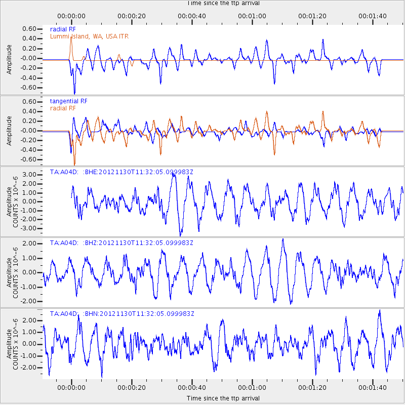
A04D Lummi Island, WA, USA - Earthquake Result Viewer
*The percent match for this event was below the threshold and hence no stack was calculated.
| Earthquake location: |
Tonga Islands |
| Earthquake latitude/longitude: |
-18.8/-175.6 |
| Earthquake time(UTC): |
2012/11/30 (335) 11:20:38 GMT |
| Earthquake Depth: |
200 km |
| Earthquake Magnitude: |
5.7 MW, 5.1 MB, 5.7 MW |
| Earthquake Catalog/Contributor: |
WHDF/NEIC |
|
| Network: |
TA USArray Transportable Network (new EarthScope stations) |
| Station: |
A04D Lummi Island, WA, USA |
| Lat/Lon: |
48.72 N/122.71 W |
| Elevation: |
13 m |
|
| Distance: |
82.1 deg |
| Az: |
32.224 deg |
| Baz: |
229.698 deg |
| Ray Param: |
$rayparam |
*The percent match for this event was below the threshold and hence was not used in the summary stack. |
|
| Radial Match: |
65.10592 % |
| Radial Bump: |
400 |
| Transverse Match: |
45.701405 % |
| Transverse Bump: |
400 |
| SOD ConfigId: |
486959 |
| Insert Time: |
2013-03-23 05:45:30.593 +0000 |
| GWidth: |
2.5 |
| Max Bumps: |
400 |
| Tol: |
0.001 |
|
Signal To Noise
| Channel | StoN | STA | LTA |
| TA:A04D: :BHZ:20121130T11:32:05.099983Z | 1.3198941 | 8.05516E-7 | 6.1028834E-7 |
| TA:A04D: :BHN:20121130T11:32:05.099983Z | 0.8676917 | 1.2236636E-6 | 1.4102516E-6 |
| TA:A04D: :BHE:20121130T11:32:05.099983Z | 2.3486261 | 1.8423176E-6 | 7.8442355E-7 |
| Arrivals |
| Ps | |
| PpPs | |
| PsPs/PpSs | |


