You are here: Home > Network List > TA - USArray Transportable Network (new EarthScope stations) Stations List
> Station Y46A Houston, MS, USA > Earthquake Result Viewer
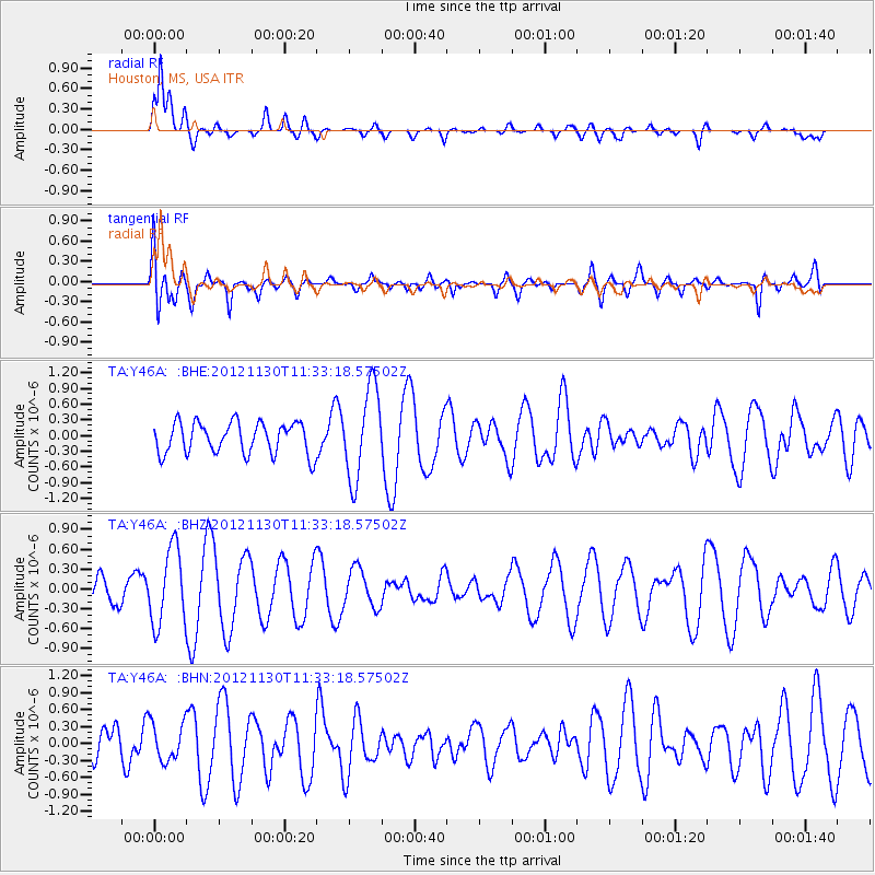
Y46A Houston, MS, USA - Earthquake Result Viewer
*The percent match for this event was below the threshold and hence no stack was calculated.
| Earthquake location: |
Tonga Islands |
| Earthquake latitude/longitude: |
-18.8/-175.6 |
| Earthquake time(UTC): |
2012/11/30 (335) 11:20:38 GMT |
| Earthquake Depth: |
200 km |
| Earthquake Magnitude: |
5.7 MW, 5.1 MB, 5.7 MW |
| Earthquake Catalog/Contributor: |
WHDF/NEIC |
|
| Network: |
TA USArray Transportable Network (new EarthScope stations) |
| Station: |
Y46A Houston, MS, USA |
| Lat/Lon: |
33.88 N/88.86 W |
| Elevation: |
109 m |
|
| Distance: |
97.7 deg |
| Az: |
56.931 deg |
| Baz: |
252.579 deg |
| Ray Param: |
$rayparam |
*The percent match for this event was below the threshold and hence was not used in the summary stack. |
|
| Radial Match: |
65.38961 % |
| Radial Bump: |
400 |
| Transverse Match: |
46.212967 % |
| Transverse Bump: |
400 |
| SOD ConfigId: |
486959 |
| Insert Time: |
2013-03-23 05:46:00.905 +0000 |
| GWidth: |
2.5 |
| Max Bumps: |
400 |
| Tol: |
0.001 |
|
Signal To Noise
| Channel | StoN | STA | LTA |
| TA:Y46A: :BHZ:20121130T11:33:18.57502Z | 3.0133276 | 5.7028336E-7 | 1.892537E-7 |
| TA:Y46A: :BHN:20121130T11:33:18.57502Z | 1.1841985 | 3.3890967E-7 | 2.861933E-7 |
| TA:Y46A: :BHE:20121130T11:33:18.57502Z | 2.8715696 | 8.582337E-7 | 2.988727E-7 |
| Arrivals |
| Ps | |
| PpPs | |
| PsPs/PpSs | |


