You are here: Home > Network List > TA - USArray Transportable Network (new EarthScope stations) Stations List
> Station T25A Trinidad, CO, USA > Earthquake Result Viewer
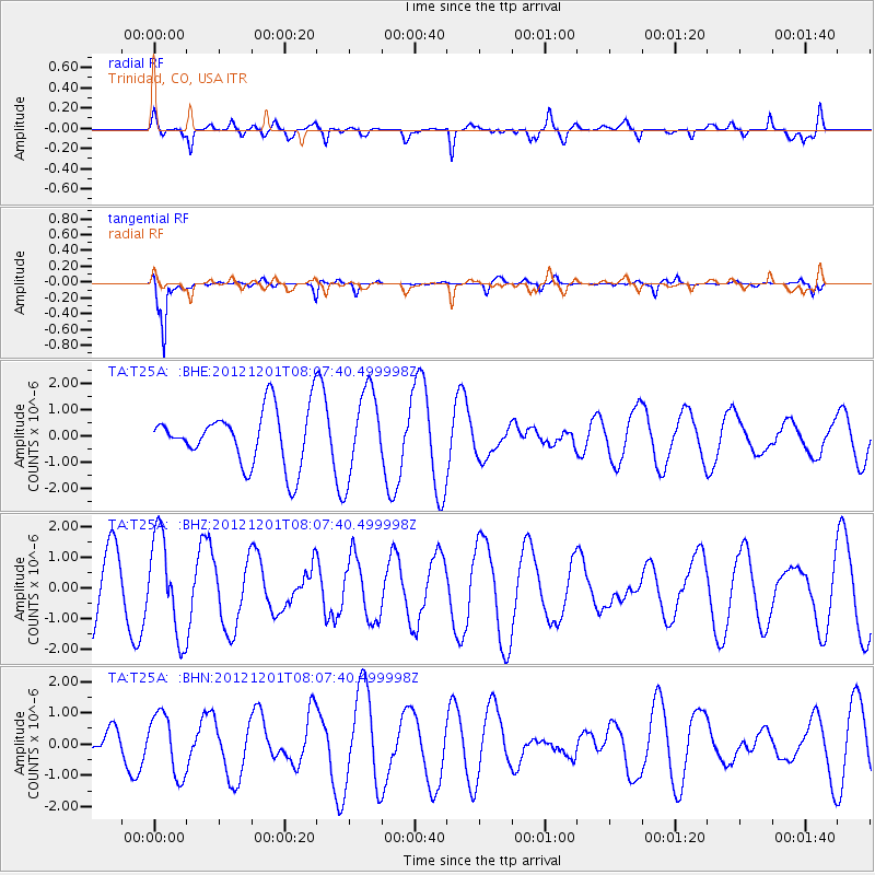
T25A Trinidad, CO, USA - Earthquake Result Viewer
*The percent match for this event was below the threshold and hence no stack was calculated.
| Earthquake location: |
Alaska Peninsula |
| Earthquake latitude/longitude: |
58.4/-154.1 |
| Earthquake time(UTC): |
2012/12/01 (336) 08:00:57 GMT |
| Earthquake Depth: |
92 km |
| Earthquake Magnitude: |
5.5 MB, 5.3 MW, 5.4 MW |
| Earthquake Catalog/Contributor: |
WHDF/NEIC |
|
| Network: |
TA USArray Transportable Network (new EarthScope stations) |
| Station: |
T25A Trinidad, CO, USA |
| Lat/Lon: |
37.14 N/104.41 W |
| Elevation: |
2017 m |
|
| Distance: |
38.5 deg |
| Az: |
101.416 deg |
| Baz: |
319.8 deg |
| Ray Param: |
$rayparam |
*The percent match for this event was below the threshold and hence was not used in the summary stack. |
|
| Radial Match: |
44.759304 % |
| Radial Bump: |
346 |
| Transverse Match: |
93.684456 % |
| Transverse Bump: |
306 |
| SOD ConfigId: |
486959 |
| Insert Time: |
2013-03-23 05:56:56.468 +0000 |
| GWidth: |
2.5 |
| Max Bumps: |
400 |
| Tol: |
0.001 |
|
Signal To Noise
| Channel | StoN | STA | LTA |
| TA:T25A: :BHZ:20121201T08:07:40.499998Z | 1.7309142 | 1.6143712E-6 | 9.3266965E-7 |
| TA:T25A: :BHN:20121201T08:07:40.499998Z | 1.5297048 | 9.8179E-7 | 6.418166E-7 |
| TA:T25A: :BHE:20121201T08:07:40.499998Z | 1.5570022 | 1.6438664E-6 | 1.0557894E-6 |
| Arrivals |
| Ps | |
| PpPs | |
| PsPs/PpSs | |


