You are here: Home > Network List > TA - USArray Transportable Network (new EarthScope stations) Stations List
> Station 348A Jackson, AL, USA > Earthquake Result Viewer
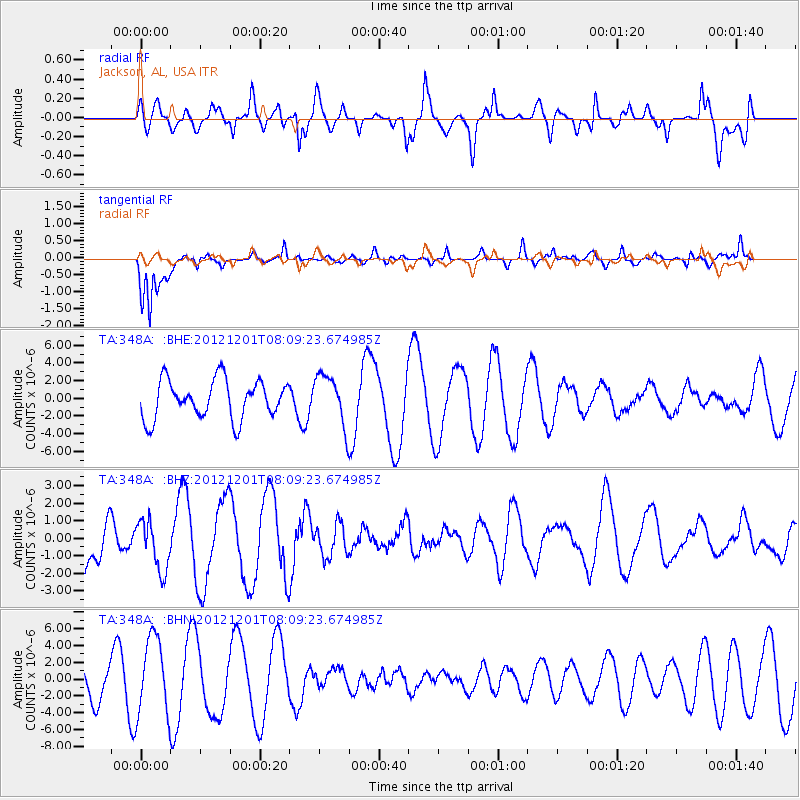
348A Jackson, AL, USA - Earthquake Result Viewer
*The percent match for this event was below the threshold and hence no stack was calculated.
| Earthquake location: |
Alaska Peninsula |
| Earthquake latitude/longitude: |
58.4/-154.1 |
| Earthquake time(UTC): |
2012/12/01 (336) 08:00:57 GMT |
| Earthquake Depth: |
92 km |
| Earthquake Magnitude: |
5.5 MB, 5.3 MW, 5.4 MW |
| Earthquake Catalog/Contributor: |
WHDF/NEIC |
|
| Network: |
TA USArray Transportable Network (new EarthScope stations) |
| Station: |
348A Jackson, AL, USA |
| Lat/Lon: |
31.41 N/87.90 W |
| Elevation: |
57 m |
|
| Distance: |
51.5 deg |
| Az: |
91.483 deg |
| Baz: |
322.029 deg |
| Ray Param: |
$rayparam |
*The percent match for this event was below the threshold and hence was not used in the summary stack. |
|
| Radial Match: |
57.840298 % |
| Radial Bump: |
400 |
| Transverse Match: |
76.45915 % |
| Transverse Bump: |
395 |
| SOD ConfigId: |
486959 |
| Insert Time: |
2013-03-23 05:57:42.434 +0000 |
| GWidth: |
2.5 |
| Max Bumps: |
400 |
| Tol: |
0.001 |
|
Signal To Noise
| Channel | StoN | STA | LTA |
| TA:348A: :BHZ:20121201T08:09:23.674985Z | 1.0265661 | 1.4246064E-6 | 1.3877395E-6 |
| TA:348A: :BHN:20121201T08:09:23.674985Z | 2.9054635 | 4.5708475E-6 | 1.5731905E-6 |
| TA:348A: :BHE:20121201T08:09:23.674985Z | 1.3220195 | 2.8713146E-6 | 2.1719156E-6 |
| Arrivals |
| Ps | |
| PpPs | |
| PsPs/PpSs | |


