You are here: Home > Network List > TA - USArray Transportable Network (new EarthScope stations) Stations List
> Station N45A Kentland, IN, USA > Earthquake Result Viewer
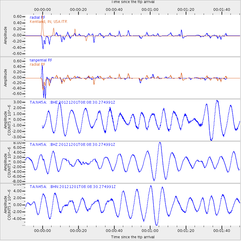
N45A Kentland, IN, USA - Earthquake Result Viewer
*The percent match for this event was below the threshold and hence no stack was calculated.
| Earthquake location: |
Alaska Peninsula |
| Earthquake latitude/longitude: |
58.4/-154.1 |
| Earthquake time(UTC): |
2012/12/01 (336) 08:00:57 GMT |
| Earthquake Depth: |
92 km |
| Earthquake Magnitude: |
5.5 MB, 5.3 MW, 5.4 MW |
| Earthquake Catalog/Contributor: |
WHDF/NEIC |
|
| Network: |
TA USArray Transportable Network (new EarthScope stations) |
| Station: |
N45A Kentland, IN, USA |
| Lat/Lon: |
40.85 N/87.51 W |
| Elevation: |
206 m |
|
| Distance: |
44.6 deg |
| Az: |
82.898 deg |
| Baz: |
316.502 deg |
| Ray Param: |
$rayparam |
*The percent match for this event was below the threshold and hence was not used in the summary stack. |
|
| Radial Match: |
63.74958 % |
| Radial Bump: |
400 |
| Transverse Match: |
95.8662 % |
| Transverse Bump: |
337 |
| SOD ConfigId: |
486959 |
| Insert Time: |
2013-03-23 05:59:23.447 +0000 |
| GWidth: |
2.5 |
| Max Bumps: |
400 |
| Tol: |
0.001 |
|
Signal To Noise
| Channel | StoN | STA | LTA |
| TA:N45A: :BHZ:20121201T08:08:30.274991Z | 1.084836 | 2.718129E-6 | 2.505567E-6 |
| TA:N45A: :BHN:20121201T08:08:30.274991Z | 3.0851698 | 2.5884817E-6 | 8.390079E-7 |
| TA:N45A: :BHE:20121201T08:08:30.274991Z | 0.70554805 | 1.0956198E-6 | 1.5528635E-6 |
| Arrivals |
| Ps | |
| PpPs | |
| PsPs/PpSs | |


