You are here: Home > Network List > TA - USArray Transportable Network (new EarthScope stations) Stations List
> Station X48A Hartselle, AL, USA > Earthquake Result Viewer
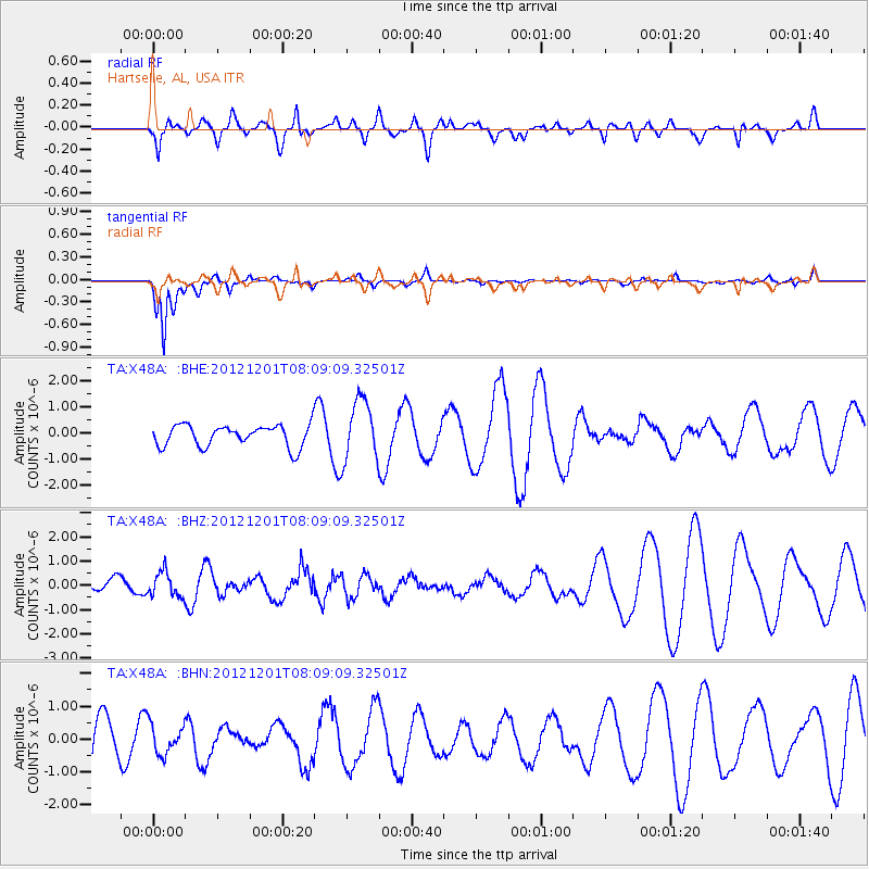
X48A Hartselle, AL, USA - Earthquake Result Viewer
*The percent match for this event was below the threshold and hence no stack was calculated.
| Earthquake location: |
Alaska Peninsula |
| Earthquake latitude/longitude: |
58.4/-154.1 |
| Earthquake time(UTC): |
2012/12/01 (336) 08:00:57 GMT |
| Earthquake Depth: |
92 km |
| Earthquake Magnitude: |
5.5 MB, 5.3 MW, 5.4 MW |
| Earthquake Catalog/Contributor: |
WHDF/NEIC |
|
| Network: |
TA USArray Transportable Network (new EarthScope stations) |
| Station: |
X48A Hartselle, AL, USA |
| Lat/Lon: |
34.45 N/87.05 W |
| Elevation: |
180 m |
|
| Distance: |
49.6 deg |
| Az: |
88.298 deg |
| Baz: |
320.469 deg |
| Ray Param: |
$rayparam |
*The percent match for this event was below the threshold and hence was not used in the summary stack. |
|
| Radial Match: |
26.916058 % |
| Radial Bump: |
400 |
| Transverse Match: |
77.88668 % |
| Transverse Bump: |
355 |
| SOD ConfigId: |
486959 |
| Insert Time: |
2013-03-23 05:59:48.284 +0000 |
| GWidth: |
2.5 |
| Max Bumps: |
400 |
| Tol: |
0.001 |
|
Signal To Noise
| Channel | StoN | STA | LTA |
| TA:X48A: :BHZ:20121201T08:09:09.32501Z | 1.2016729 | 5.050605E-7 | 4.2029782E-7 |
| TA:X48A: :BHN:20121201T08:09:09.32501Z | 0.52390593 | 4.496818E-7 | 8.5832545E-7 |
| TA:X48A: :BHE:20121201T08:09:09.32501Z | 2.8195338 | 1.1741714E-6 | 4.164417E-7 |
| Arrivals |
| Ps | |
| PpPs | |
| PsPs/PpSs | |


