You are here: Home > Network List > TA - USArray Transportable Network (new EarthScope stations) Stations List
> Station H17A Grant Village (NPS), Yellowstone Nt. Park, WY, USA > Earthquake Result Viewer
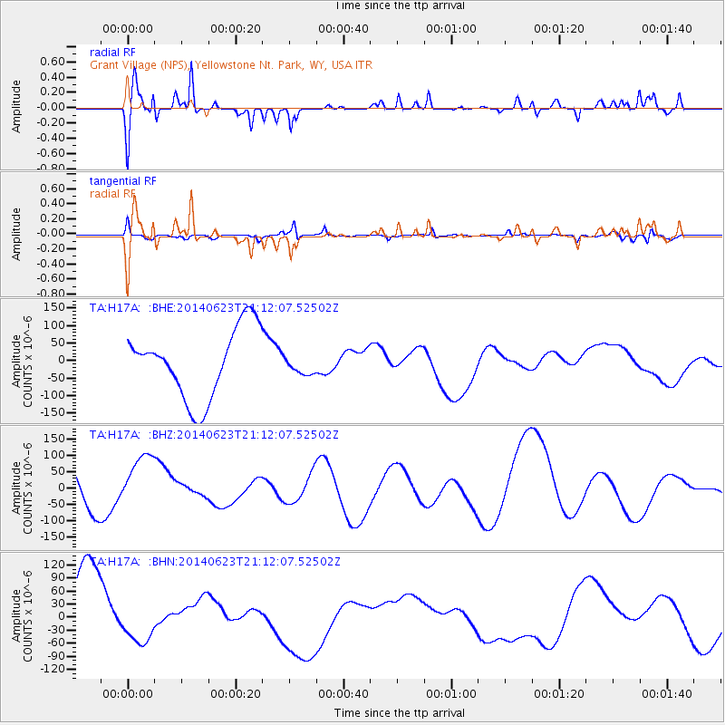
H17A Grant Village (NPS), Yellowstone Nt. Park, WY, USA - Earthquake Result Viewer
*The percent match for this event was below the threshold and hence no stack was calculated.
| Earthquake location: |
Kermadec Islands, New Zealand |
| Earthquake latitude/longitude: |
-30.2/-177.2 |
| Earthquake time(UTC): |
2014/06/23 (174) 20:59:14 GMT |
| Earthquake Depth: |
24 km |
| Earthquake Magnitude: |
5.1 mb |
| Earthquake Catalog/Contributor: |
ISC/ISC |
|
| Network: |
TA USArray Transportable Network (new EarthScope stations) |
| Station: |
H17A Grant Village (NPS), Yellowstone Nt. Park, WY, USA |
| Lat/Lon: |
44.40 N/110.58 W |
| Elevation: |
2400 m |
|
| Distance: |
95.9 deg |
| Az: |
41.432 deg |
| Baz: |
233.015 deg |
| Ray Param: |
$rayparam |
*The percent match for this event was below the threshold and hence was not used in the summary stack. |
|
| Radial Match: |
47.183605 % |
| Radial Bump: |
400 |
| Transverse Match: |
56.30706 % |
| Transverse Bump: |
353 |
| SOD ConfigId: |
3390531 |
| Insert Time: |
2019-04-12 10:36:55.656 +0000 |
| GWidth: |
2.5 |
| Max Bumps: |
400 |
| Tol: |
0.001 |
|
Signal To Noise
| Channel | StoN | STA | LTA |
| TA:H17A: :BHZ:20140623T21:12:07.52502Z | 2.1925173 | 9.4485535E-5 | 4.3094547E-5 |
| TA:H17A: :BHN:20140623T21:12:07.52502Z | 0.57456654 | 4.6246914E-5 | 8.049009E-5 |
| TA:H17A: :BHE:20140623T21:12:07.52502Z | 0.2627727 | 2.5845306E-5 | 9.835612E-5 |
| Arrivals |
| Ps | |
| PpPs | |
| PsPs/PpSs | |


