You are here: Home > Network List > CI - Caltech Regional Seismic Network Stations List
> Station DGR Domenigoni Reservoir, California, USA > Earthquake Result Viewer
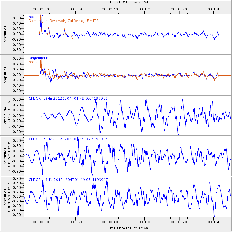
DGR Domenigoni Reservoir, California, USA - Earthquake Result Viewer
*The percent match for this event was below the threshold and hence no stack was calculated.
| Earthquake location: |
Southern Alaska |
| Earthquake latitude/longitude: |
61.2/-150.8 |
| Earthquake time(UTC): |
2012/12/04 (339) 01:42:48 GMT |
| Earthquake Depth: |
62 km |
| Earthquake Magnitude: |
5.6 MB, 5.8 MW, 5.7 MW |
| Earthquake Catalog/Contributor: |
WHDF/NEIC |
|
| Network: |
CI Caltech Regional Seismic Network |
| Station: |
DGR Domenigoni Reservoir, California, USA |
| Lat/Lon: |
33.65 N/117.01 W |
| Elevation: |
609 m |
|
| Distance: |
35.1 deg |
| Az: |
126.288 deg |
| Baz: |
332.135 deg |
| Ray Param: |
$rayparam |
*The percent match for this event was below the threshold and hence was not used in the summary stack. |
|
| Radial Match: |
69.5493 % |
| Radial Bump: |
400 |
| Transverse Match: |
72.30872 % |
| Transverse Bump: |
400 |
| SOD ConfigId: |
488671 |
| Insert Time: |
2013-03-29 03:23:50.364 +0000 |
| GWidth: |
2.5 |
| Max Bumps: |
400 |
| Tol: |
0.001 |
|
Signal To Noise
| Channel | StoN | STA | LTA |
| CI:DGR: :BHZ:20121204T01:49:05.419991Z | 2.8373578 | 4.8595103E-7 | 1.7126887E-7 |
| CI:DGR: :BHN:20121204T01:49:05.419991Z | 2.028026 | 3.3012654E-7 | 1.6278219E-7 |
| CI:DGR: :BHE:20121204T01:49:05.419991Z | 2.3786552 | 3.3318545E-7 | 1.4007304E-7 |
| Arrivals |
| Ps | |
| PpPs | |
| PsPs/PpSs | |


