You are here: Home > Network List > CI - Caltech Regional Seismic Network Stations List
> Station MPM Manuel Prospect Mine, California, USA > Earthquake Result Viewer
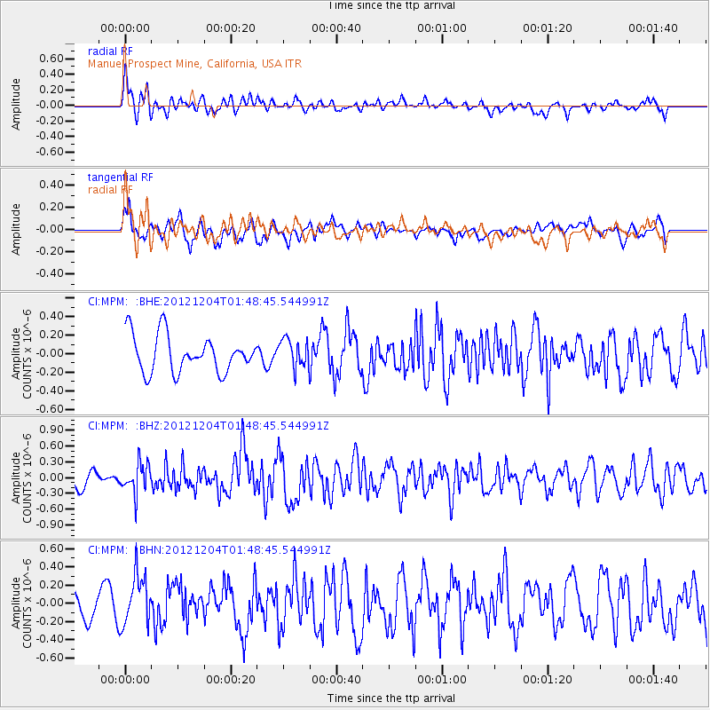
MPM Manuel Prospect Mine, California, USA - Earthquake Result Viewer
*The percent match for this event was below the threshold and hence no stack was calculated.
| Earthquake location: |
Southern Alaska |
| Earthquake latitude/longitude: |
61.2/-150.8 |
| Earthquake time(UTC): |
2012/12/04 (339) 01:42:48 GMT |
| Earthquake Depth: |
62 km |
| Earthquake Magnitude: |
5.6 MB, 5.8 MW, 5.7 MW |
| Earthquake Catalog/Contributor: |
WHDF/NEIC |
|
| Network: |
CI Caltech Regional Seismic Network |
| Station: |
MPM Manuel Prospect Mine, California, USA |
| Lat/Lon: |
36.06 N/117.49 W |
| Elevation: |
185 m |
|
| Distance: |
32.8 deg |
| Az: |
124.849 deg |
| Baz: |
330.669 deg |
| Ray Param: |
$rayparam |
*The percent match for this event was below the threshold and hence was not used in the summary stack. |
|
| Radial Match: |
56.25896 % |
| Radial Bump: |
400 |
| Transverse Match: |
55.73282 % |
| Transverse Bump: |
400 |
| SOD ConfigId: |
488671 |
| Insert Time: |
2013-03-29 03:24:05.297 +0000 |
| GWidth: |
2.5 |
| Max Bumps: |
400 |
| Tol: |
0.001 |
|
Signal To Noise
| Channel | StoN | STA | LTA |
| CI:MPM: :BHZ:20121204T01:48:45.544991Z | 1.888811 | 2.8087732E-7 | 1.4870588E-7 |
| CI:MPM: :BHN:20121204T01:48:45.544991Z | 2.3459678 | 2.8381228E-7 | 1.2097878E-7 |
| CI:MPM: :BHE:20121204T01:48:45.544991Z | 0.7759331 | 1.5350743E-7 | 1.9783592E-7 |
| Arrivals |
| Ps | |
| PpPs | |
| PsPs/PpSs | |


