You are here: Home > Network List > TA - USArray Transportable Network (new EarthScope stations) Stations List
> Station Z46A Louisville, MS, USA > Earthquake Result Viewer
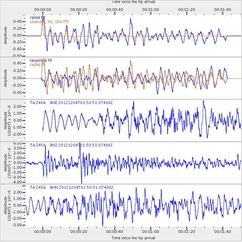
Z46A Louisville, MS, USA - Earthquake Result Viewer
*The percent match for this event was below the threshold and hence no stack was calculated.
| Earthquake location: |
Southern Alaska |
| Earthquake latitude/longitude: |
61.2/-150.8 |
| Earthquake time(UTC): |
2012/12/04 (339) 01:42:48 GMT |
| Earthquake Depth: |
62 km |
| Earthquake Magnitude: |
5.6 MB, 5.8 MW, 5.7 MW |
| Earthquake Catalog/Contributor: |
WHDF/NEIC |
|
| Network: |
TA USArray Transportable Network (new EarthScope stations) |
| Station: |
Z46A Louisville, MS, USA |
| Lat/Lon: |
33.19 N/88.94 W |
| Elevation: |
125 m |
|
| Distance: |
48.1 deg |
| Az: |
96.411 deg |
| Baz: |
325.025 deg |
| Ray Param: |
$rayparam |
*The percent match for this event was below the threshold and hence was not used in the summary stack. |
|
| Radial Match: |
48.737198 % |
| Radial Bump: |
400 |
| Transverse Match: |
65.07717 % |
| Transverse Bump: |
400 |
| SOD ConfigId: |
488671 |
| Insert Time: |
2013-03-29 03:34:32.411 +0000 |
| GWidth: |
2.5 |
| Max Bumps: |
400 |
| Tol: |
0.001 |
|
Signal To Noise
| Channel | StoN | STA | LTA |
| TA:Z46A: :BHZ:20121204T01:50:51.07499Z | 7.735088 | 1.4599821E-6 | 1.8874795E-7 |
| TA:Z46A: :BHN:20121204T01:50:51.07499Z | 1.3467246 | 9.350517E-7 | 6.943154E-7 |
| TA:Z46A: :BHE:20121204T01:50:51.07499Z | 0.872486 | 7.034505E-7 | 8.062599E-7 |
| Arrivals |
| Ps | |
| PpPs | |
| PsPs/PpSs | |


