You are here: Home > Network List > TA - USArray Transportable Network (new EarthScope stations) Stations List
> Station U41A Viola, AR, USA > Earthquake Result Viewer
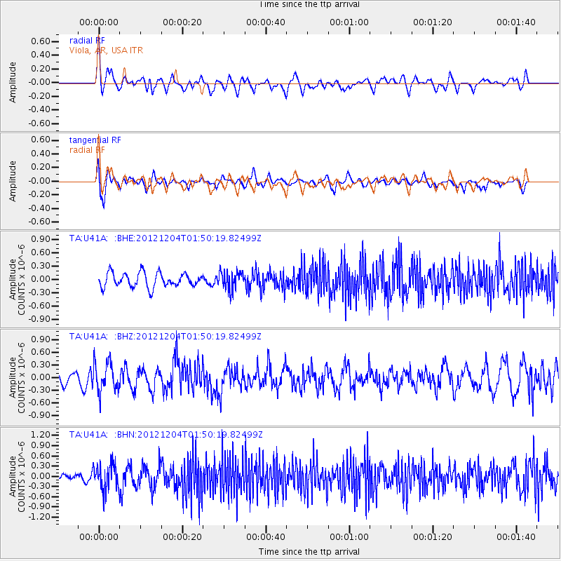
U41A Viola, AR, USA - Earthquake Result Viewer
*The percent match for this event was below the threshold and hence no stack was calculated.
| Earthquake location: |
Southern Alaska |
| Earthquake latitude/longitude: |
61.2/-150.8 |
| Earthquake time(UTC): |
2012/12/04 (339) 01:42:48 GMT |
| Earthquake Depth: |
62 km |
| Earthquake Magnitude: |
5.6 MB, 5.8 MW, 5.7 MW |
| Earthquake Catalog/Contributor: |
WHDF/NEIC |
|
| Network: |
TA USArray Transportable Network (new EarthScope stations) |
| Station: |
U41A Viola, AR, USA |
| Lat/Lon: |
36.34 N/91.92 W |
| Elevation: |
300 m |
|
| Distance: |
44.1 deg |
| Az: |
96.626 deg |
| Baz: |
323.482 deg |
| Ray Param: |
$rayparam |
*The percent match for this event was below the threshold and hence was not used in the summary stack. |
|
| Radial Match: |
67.652245 % |
| Radial Bump: |
400 |
| Transverse Match: |
63.608192 % |
| Transverse Bump: |
400 |
| SOD ConfigId: |
488671 |
| Insert Time: |
2013-03-29 03:37:05.093 +0000 |
| GWidth: |
2.5 |
| Max Bumps: |
400 |
| Tol: |
0.001 |
|
Signal To Noise
| Channel | StoN | STA | LTA |
| TA:U41A: :BHZ:20121204T01:50:19.82499Z | 2.4323878 | 3.3114304E-7 | 1.3613908E-7 |
| TA:U41A: :BHN:20121204T01:50:19.82499Z | 2.8157082 | 3.7260995E-7 | 1.3233259E-7 |
| TA:U41A: :BHE:20121204T01:50:19.82499Z | 1.3356879 | 2.1112058E-7 | 1.5806131E-7 |
| Arrivals |
| Ps | |
| PpPs | |
| PsPs/PpSs | |


