You are here: Home > Network List > TA - USArray Transportable Network (new EarthScope stations) Stations List
> Station J62A Henniker, NH, USA > Earthquake Result Viewer
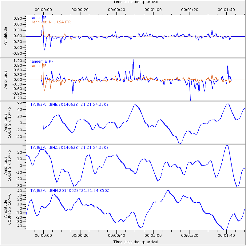
J62A Henniker, NH, USA - Earthquake Result Viewer
*The percent match for this event was below the threshold and hence no stack was calculated.
| Earthquake location: |
Rat Islands, Aleutian Islands |
| Earthquake latitude/longitude: |
52.0/178.4 |
| Earthquake time(UTC): |
2014/06/23 (174) 21:11:41 GMT |
| Earthquake Depth: |
107 km |
| Earthquake Magnitude: |
6.0 MB |
| Earthquake Catalog/Contributor: |
NEIC PDE/NEIC COMCAT |
|
| Network: |
TA USArray Transportable Network (new EarthScope stations) |
| Station: |
J62A Henniker, NH, USA |
| Lat/Lon: |
43.23 N/71.81 W |
| Elevation: |
266 m |
|
| Distance: |
67.5 deg |
| Az: |
48.13 deg |
| Baz: |
320.927 deg |
| Ray Param: |
$rayparam |
*The percent match for this event was below the threshold and hence was not used in the summary stack. |
|
| Radial Match: |
78.46542 % |
| Radial Bump: |
400 |
| Transverse Match: |
80.13437 % |
| Transverse Bump: |
234 |
| SOD ConfigId: |
3390531 |
| Insert Time: |
2019-04-12 10:57:17.798 +0000 |
| GWidth: |
2.5 |
| Max Bumps: |
400 |
| Tol: |
0.001 |
|
Signal To Noise
| Channel | StoN | STA | LTA |
| TA:J62A: :BHZ:20140623T21:21:54.350Z | 1.7659222 | 2.1752165E-5 | 1.2317736E-5 |
| TA:J62A: :BHN:20140623T21:21:54.350Z | 0.6780963 | 1.6234591E-5 | 2.3941422E-5 |
| TA:J62A: :BHE:20140623T21:21:54.350Z | 0.78086036 | 1.12877215E-5 | 1.4455493E-5 |
| Arrivals |
| Ps | |
| PpPs | |
| PsPs/PpSs | |


