You are here: Home > Network List > TA - USArray Transportable Network (new EarthScope stations) Stations List
> Station R54A Victor, WV, USA > Earthquake Result Viewer
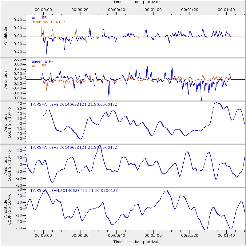
R54A Victor, WV, USA - Earthquake Result Viewer
*The percent match for this event was below the threshold and hence no stack was calculated.
| Earthquake location: |
Rat Islands, Aleutian Islands |
| Earthquake latitude/longitude: |
52.0/178.4 |
| Earthquake time(UTC): |
2014/06/23 (174) 21:11:41 GMT |
| Earthquake Depth: |
107 km |
| Earthquake Magnitude: |
6.0 MB |
| Earthquake Catalog/Contributor: |
NEIC PDE/NEIC COMCAT |
|
| Network: |
TA USArray Transportable Network (new EarthScope stations) |
| Station: |
R54A Victor, WV, USA |
| Lat/Lon: |
38.18 N/80.99 W |
| Elevation: |
512 m |
|
| Distance: |
66.8 deg |
| Az: |
57.435 deg |
| Baz: |
318.574 deg |
| Ray Param: |
$rayparam |
*The percent match for this event was below the threshold and hence was not used in the summary stack. |
|
| Radial Match: |
48.762234 % |
| Radial Bump: |
254 |
| Transverse Match: |
69.07105 % |
| Transverse Bump: |
296 |
| SOD ConfigId: |
3390531 |
| Insert Time: |
2019-04-12 10:57:33.958 +0000 |
| GWidth: |
2.5 |
| Max Bumps: |
400 |
| Tol: |
0.001 |
|
Signal To Noise
| Channel | StoN | STA | LTA |
| TA:R54A: :BHZ:20140623T21:21:50.050012Z | 1.2795256 | 1.4398353E-5 | 1.1252884E-5 |
| TA:R54A: :BHN:20140623T21:21:50.050012Z | 2.2015228 | 2.7370814E-5 | 1.2432673E-5 |
| TA:R54A: :BHE:20140623T21:21:50.050012Z | 1.1946524 | 1.9546313E-5 | 1.6361506E-5 |
| Arrivals |
| Ps | |
| PpPs | |
| PsPs/PpSs | |


