You are here: Home > Network List > TA - USArray Transportable Network (new EarthScope stations) Stations List
> Station L48A N Adams, MI, USA > Earthquake Result Viewer
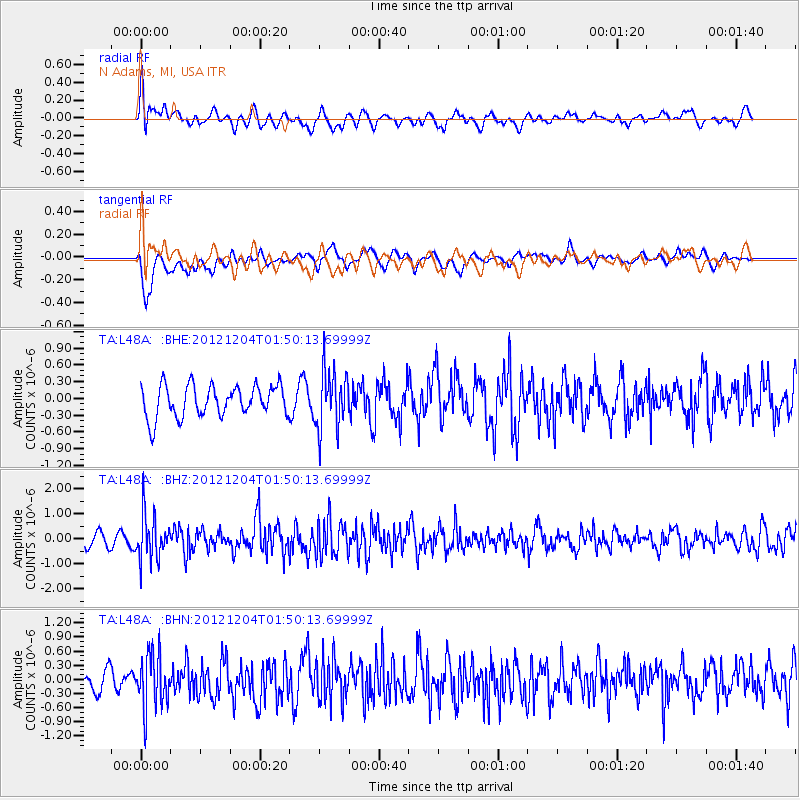
L48A N Adams, MI, USA - Earthquake Result Viewer
*The percent match for this event was below the threshold and hence no stack was calculated.
| Earthquake location: |
Southern Alaska |
| Earthquake latitude/longitude: |
61.2/-150.8 |
| Earthquake time(UTC): |
2012/12/04 (339) 01:42:48 GMT |
| Earthquake Depth: |
62 km |
| Earthquake Magnitude: |
5.6 MB, 5.8 MW, 5.7 MW |
| Earthquake Catalog/Contributor: |
WHDF/NEIC |
|
| Network: |
TA USArray Transportable Network (new EarthScope stations) |
| Station: |
L48A N Adams, MI, USA |
| Lat/Lon: |
41.94 N/84.43 W |
| Elevation: |
369 m |
|
| Distance: |
43.3 deg |
| Az: |
84.989 deg |
| Baz: |
319.77 deg |
| Ray Param: |
$rayparam |
*The percent match for this event was below the threshold and hence was not used in the summary stack. |
|
| Radial Match: |
61.832024 % |
| Radial Bump: |
400 |
| Transverse Match: |
70.080284 % |
| Transverse Bump: |
400 |
| SOD ConfigId: |
488671 |
| Insert Time: |
2013-03-29 03:48:24.769 +0000 |
| GWidth: |
2.5 |
| Max Bumps: |
400 |
| Tol: |
0.001 |
|
Signal To Noise
| Channel | StoN | STA | LTA |
| TA:L48A: :BHZ:20121204T01:50:13.69999Z | 2.8207788 | 9.0741815E-7 | 3.2169064E-7 |
| TA:L48A: :BHN:20121204T01:50:13.69999Z | 2.0849717 | 5.65853E-7 | 2.71396E-7 |
| TA:L48A: :BHE:20121204T01:50:13.69999Z | 1.8486322 | 5.174645E-7 | 2.7991751E-7 |
| Arrivals |
| Ps | |
| PpPs | |
| PsPs/PpSs | |


