You are here: Home > Network List > TA - USArray Transportable Network (new EarthScope stations) Stations List
> Station K46A Dorr, MI, USA > Earthquake Result Viewer
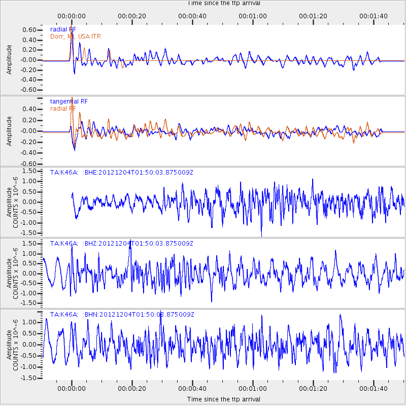
K46A Dorr, MI, USA - Earthquake Result Viewer
*The percent match for this event was below the threshold and hence no stack was calculated.
| Earthquake location: |
Southern Alaska |
| Earthquake latitude/longitude: |
61.2/-150.8 |
| Earthquake time(UTC): |
2012/12/04 (339) 01:42:48 GMT |
| Earthquake Depth: |
62 km |
| Earthquake Magnitude: |
5.6 MB, 5.8 MW, 5.7 MW |
| Earthquake Catalog/Contributor: |
WHDF/NEIC |
|
| Network: |
TA USArray Transportable Network (new EarthScope stations) |
| Station: |
K46A Dorr, MI, USA |
| Lat/Lon: |
42.69 N/85.78 W |
| Elevation: |
213 m |
|
| Distance: |
42.1 deg |
| Az: |
85.4 deg |
| Baz: |
319.167 deg |
| Ray Param: |
$rayparam |
*The percent match for this event was below the threshold and hence was not used in the summary stack. |
|
| Radial Match: |
55.22944 % |
| Radial Bump: |
400 |
| Transverse Match: |
62.355953 % |
| Transverse Bump: |
400 |
| SOD ConfigId: |
488671 |
| Insert Time: |
2013-03-29 03:49:35.592 +0000 |
| GWidth: |
2.5 |
| Max Bumps: |
400 |
| Tol: |
0.001 |
|
Signal To Noise
| Channel | StoN | STA | LTA |
| TA:K46A: :BHZ:20121204T01:50:03.875009Z | 1.6208408 | 6.02391E-7 | 3.716534E-7 |
| TA:K46A: :BHN:20121204T01:50:03.875009Z | 1.3468964 | 5.293731E-7 | 3.9303177E-7 |
| TA:K46A: :BHE:20121204T01:50:03.875009Z | 1.1418773 | 2.8915375E-7 | 2.5322663E-7 |
| Arrivals |
| Ps | |
| PpPs | |
| PsPs/PpSs | |


