You are here: Home > Network List > TA - USArray Transportable Network (new EarthScope stations) Stations List
> Station J45A Montague, MI, USA > Earthquake Result Viewer
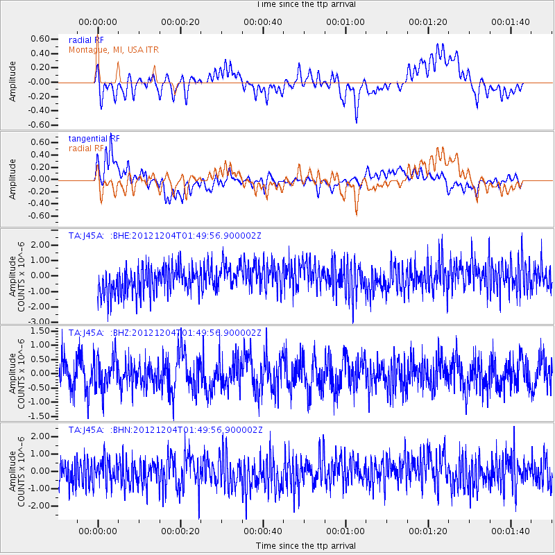
J45A Montague, MI, USA - Earthquake Result Viewer
*The percent match for this event was below the threshold and hence no stack was calculated.
| Earthquake location: |
Southern Alaska |
| Earthquake latitude/longitude: |
61.2/-150.8 |
| Earthquake time(UTC): |
2012/12/04 (339) 01:42:48 GMT |
| Earthquake Depth: |
62 km |
| Earthquake Magnitude: |
5.6 MB, 5.8 MW, 5.7 MW |
| Earthquake Catalog/Contributor: |
WHDF/NEIC |
|
| Network: |
TA USArray Transportable Network (new EarthScope stations) |
| Station: |
J45A Montague, MI, USA |
| Lat/Lon: |
43.44 N/86.39 W |
| Elevation: |
209 m |
|
| Distance: |
41.2 deg |
| Az: |
85.162 deg |
| Baz: |
318.577 deg |
| Ray Param: |
$rayparam |
*The percent match for this event was below the threshold and hence was not used in the summary stack. |
|
| Radial Match: |
50.92464 % |
| Radial Bump: |
400 |
| Transverse Match: |
56.96721 % |
| Transverse Bump: |
400 |
| SOD ConfigId: |
488671 |
| Insert Time: |
2013-03-29 03:49:47.473 +0000 |
| GWidth: |
2.5 |
| Max Bumps: |
400 |
| Tol: |
0.001 |
|
Signal To Noise
| Channel | StoN | STA | LTA |
| TA:J45A: :BHZ:20121204T01:49:56.900002Z | 1.3668672 | 5.8051785E-7 | 4.2470685E-7 |
| TA:J45A: :BHN:20121204T01:49:56.900002Z | 0.8732953 | 6.53202E-7 | 7.4797384E-7 |
| TA:J45A: :BHE:20121204T01:49:56.900002Z | 1.0880302 | 9.025111E-7 | 8.2949083E-7 |
| Arrivals |
| Ps | |
| PpPs | |
| PsPs/PpSs | |


