You are here: Home > Network List > TA - USArray Transportable Network (new EarthScope stations) Stations List
> Station I48A Sherman Twp, MI, USA > Earthquake Result Viewer
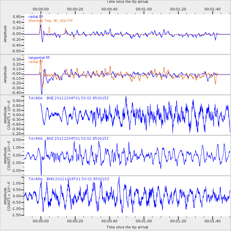
I48A Sherman Twp, MI, USA - Earthquake Result Viewer
*The percent match for this event was below the threshold and hence no stack was calculated.
| Earthquake location: |
Southern Alaska |
| Earthquake latitude/longitude: |
61.2/-150.8 |
| Earthquake time(UTC): |
2012/12/04 (339) 01:42:48 GMT |
| Earthquake Depth: |
62 km |
| Earthquake Magnitude: |
5.6 MB, 5.8 MW, 5.7 MW |
| Earthquake Catalog/Contributor: |
WHDF/NEIC |
|
| Network: |
TA USArray Transportable Network (new EarthScope stations) |
| Station: |
I48A Sherman Twp, MI, USA |
| Lat/Lon: |
44.19 N/83.70 W |
| Elevation: |
192 m |
|
| Distance: |
42.0 deg |
| Az: |
82.22 deg |
| Baz: |
318.23 deg |
| Ray Param: |
$rayparam |
*The percent match for this event was below the threshold and hence was not used in the summary stack. |
|
| Radial Match: |
51.879303 % |
| Radial Bump: |
400 |
| Transverse Match: |
73.01312 % |
| Transverse Bump: |
400 |
| SOD ConfigId: |
488671 |
| Insert Time: |
2013-03-29 03:50:40.489 +0000 |
| GWidth: |
2.5 |
| Max Bumps: |
400 |
| Tol: |
0.001 |
|
Signal To Noise
| Channel | StoN | STA | LTA |
| TA:I48A: :BHZ:20121204T01:50:02.850015Z | 2.6499872 | 8.515935E-7 | 3.213576E-7 |
| TA:I48A: :BHN:20121204T01:50:02.850015Z | 2.1807997 | 6.3075095E-7 | 2.8922918E-7 |
| TA:I48A: :BHE:20121204T01:50:02.850015Z | 1.0284053 | 2.9101824E-7 | 2.8298007E-7 |
| Arrivals |
| Ps | |
| PpPs | |
| PsPs/PpSs | |


