You are here: Home > Network List > TA - USArray Transportable Network (new EarthScope stations) Stations List
> Station 435B Jarrell, TX, USA > Earthquake Result Viewer
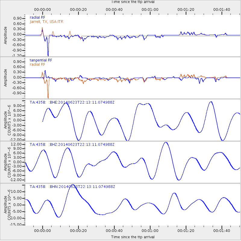
435B Jarrell, TX, USA - Earthquake Result Viewer
*The percent match for this event was below the threshold and hence no stack was calculated.
| Earthquake location: |
Rat Islands, Aleutian Islands |
| Earthquake latitude/longitude: |
52.0/178.4 |
| Earthquake time(UTC): |
2014/06/23 (174) 22:03:28 GMT |
| Earthquake Depth: |
120 km |
| Earthquake Magnitude: |
5.1 mb |
| Earthquake Catalog/Contributor: |
ISC/ISC |
|
| Network: |
TA USArray Transportable Network (new EarthScope stations) |
| Station: |
435B Jarrell, TX, USA |
| Lat/Lon: |
30.78 N/97.58 W |
| Elevation: |
248 m |
|
| Distance: |
62.9 deg |
| Az: |
74.064 deg |
| Baz: |
316.273 deg |
| Ray Param: |
$rayparam |
*The percent match for this event was below the threshold and hence was not used in the summary stack. |
|
| Radial Match: |
64.939186 % |
| Radial Bump: |
400 |
| Transverse Match: |
52.418488 % |
| Transverse Bump: |
385 |
| SOD ConfigId: |
3390531 |
| Insert Time: |
2019-04-12 11:14:24.801 +0000 |
| GWidth: |
2.5 |
| Max Bumps: |
400 |
| Tol: |
0.001 |
|
Signal To Noise
| Channel | StoN | STA | LTA |
| TA:435B: :BHZ:20140623T22:13:11.074988Z | 1.7424085 | 6.340118E-6 | 3.6387094E-6 |
| TA:435B: :BHN:20140623T22:13:11.074988Z | 1.0816469 | 4.7678127E-6 | 4.4079197E-6 |
| TA:435B: :BHE:20140623T22:13:11.074988Z | 1.2479651 | 8.373411E-6 | 6.709651E-6 |
| Arrivals |
| Ps | |
| PpPs | |
| PsPs/PpSs | |


