OSI Osito Adit, California, USA - Earthquake Result Viewer
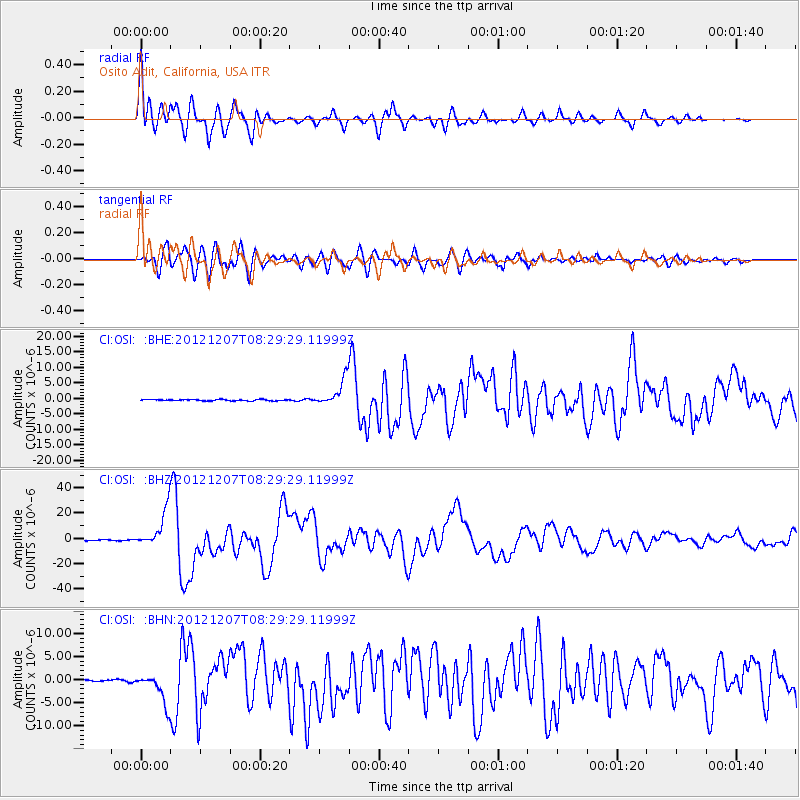
Earthquake location: Off East Coast Of Honshu, Japan
Earthquake latitude/longitude: 37.9/143.9
Earthquake time(UTC): 2012/12/07 (342) 08:18:23 GMT
Earthquake Depth: 31 km
Earthquake Magnitude: 7.2 MB, 7.3 MS, 7.3 MW, 7.3 MW
Earthquake Catalog/Contributor: WHDF/NEIC
Network: CI Caltech Regional Seismic Network
Station: OSI Osito Adit, California, USA
Lat/Lon: 34.61 N/118.72 W
Elevation: 706 m
Distance: 74.8 deg
Az: 57.972 deg
Baz: 305.584 deg
Ray Param: 0.052063204
Estimated Moho Depth: 14.5 km
Estimated Crust Vp/Vs: 1.61
Assumed Crust Vp: 6.1 km/s
Estimated Crust Vs: 3.783 km/s
Estimated Crust Poisson's Ratio: 0.19
Radial Match: 94.38295 %
Radial Bump: 400
Transverse Match: 91.60883 %
Transverse Bump: 400
SOD ConfigId: 488671
Insert Time: 2013-03-29 04:11:11.303 +0000
GWidth: 2.5
Max Bumps: 400
Tol: 0.001

Signal To Noise

ChannelStoNSTALTA
CI:OSI: :BHZ:20121207T08:29:29.11999Z52.12741.4687765E-52.817667E-7
CI:OSI: :BHN:20121207T08:29:29.11999Z11.4302573.2840019E-62.873078E-7
CI:OSI: :BHE:20121207T08:29:29.11999Z20.3015444.2841807E-62.1102731E-7
Arrivals
Ps1.5 SECOND
PpPs6.0 SECOND
PsPs/PpSs7.5 SECOND