
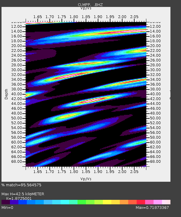
MPP McPhearson Peak - Earthquake Result Viewer
| ||||||||||||||||||
| ||||||||||||||||||
| ||||||||||||||||||
|
Signal To Noise
| Channel | StoN | STA | LTA |
| CI:MPP: :BHZ:20121207T08:29:23.970027Z | 27.574093 | 1.3019586E-5 | 4.7216733E-7 |
| CI:MPP: :BHN:20121207T08:29:23.970027Z | 4.053854 | 1.6253455E-6 | 4.0093832E-7 |
| CI:MPP: :BHE:20121207T08:29:23.970027Z | 9.031451 | 4.533881E-6 | 5.020102E-7 |
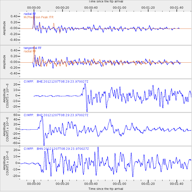
| Arrivals | |
| Ps | 6.3 SECOND |
| PpPs | 19 SECOND |
| PsPs/PpSs | 26 SECOND |

