
SADO SADOWA, ON - Earthquake Result Viewer
| ||||||||||||||||||
| ||||||||||||||||||
| ||||||||||||||||||
|
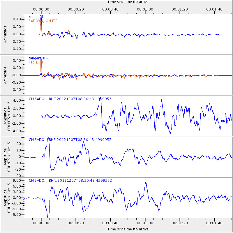
Signal To Noise
| Channel | StoN | STA | LTA |
| CN:SADO: :BHZ:20121207T08:30:43.499995Z | 54.782642 | 1.5325697E-5 | 2.7975463E-7 |
| CN:SADO: :BHN:20121207T08:30:43.499995Z | 24.386467 | 5.3316103E-6 | 2.1862988E-7 |
| CN:SADO: :BHE:20121207T08:30:43.499995Z | 10.529266 | 2.465517E-6 | 2.3415846E-7 |
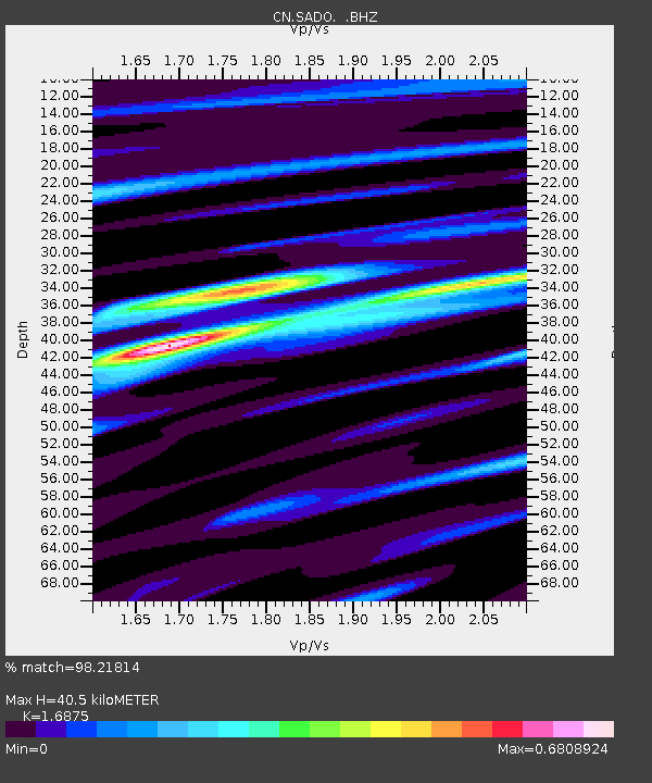
| Arrivals | |
| Ps | 4.3 SECOND |
| PpPs | 16 SECOND |
| PsPs/PpSs | 21 SECOND |

