
UTMT Martin, TN - Earthquake Result Viewer
| ||||||||||||||||||
| ||||||||||||||||||
| ||||||||||||||||||
|
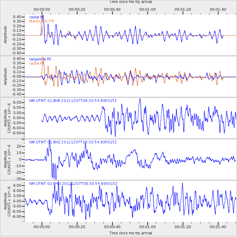
Signal To Noise
| Channel | StoN | STA | LTA |
| NM:UTMT:01:BHZ:20121207T08:30:54.895015Z | 34.47901 | 1.1015553E-5 | 3.1948576E-7 |
| NM:UTMT:01:BHN:20121207T08:30:54.895015Z | 2.7429848 | 3.0246636E-6 | 1.1026906E-6 |
| NM:UTMT:01:BHE:20121207T08:30:54.895015Z | 2.4528944 | 2.681818E-6 | 1.0933279E-6 |
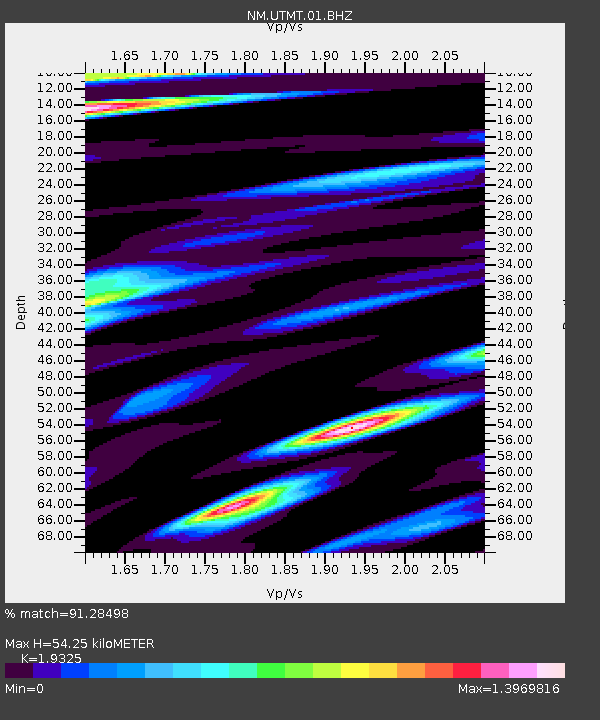
| Arrivals | |
| Ps | 8.0 SECOND |
| PpPs | 24 SECOND |
| PsPs/PpSs | 32 SECOND |

