Q24A Divide, CO, USA - Earthquake Result Viewer
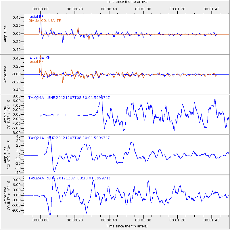
Earthquake location: Off East Coast Of Honshu, Japan
Earthquake latitude/longitude: 37.9/143.9
Earthquake time(UTC): 2012/12/07 (342) 08:18:23 GMT
Earthquake Depth: 31 km
Earthquake Magnitude: 7.2 MB, 7.3 MS, 7.3 MW, 7.3 MW
Earthquake Catalog/Contributor: WHDF/NEIC
Network: TA USArray Transportable Network (new EarthScope stations)
Station: Q24A Divide, CO, USA
Lat/Lon: 38.96 N/105.15 W
Elevation: 2775 m
Distance: 80.6 deg
Az: 47.575 deg
Baz: 311.485 deg
Ray Param: 0.04811188
Estimated Moho Depth: 22.75 km
Estimated Crust Vp/Vs: 1.81
Assumed Crust Vp: 6.159 km/s
Estimated Crust Vs: 3.412 km/s
Estimated Crust Poisson's Ratio: 0.28
Radial Match: 96.136826 %
Radial Bump: 400
Transverse Match: 93.27517 %
Transverse Bump: 400
SOD ConfigId: 488671
Insert Time: 2013-03-29 04:26:03.805 +0000
GWidth: 2.5
Max Bumps: 400
Tol: 0.001

Signal To Noise

ChannelStoNSTALTA
TA:Q24A: :BHZ:20121207T08:30:01.599971Z92.201331.0515655E-51.1405101E-7
TA:Q24A: :BHN:20121207T08:30:01.599971Z23.506322.9456844E-61.2531456E-7
TA:Q24A: :BHE:20121207T08:30:01.599971Z19.098092.3653001E-61.2385009E-7
Arrivals
Ps3.0 SECOND
PpPs10 SECOND
PsPs/PpSs13 SECOND