
MDND Maddock, ND, USA - Earthquake Result Viewer
| ||||||||||||||||||
| ||||||||||||||||||
| ||||||||||||||||||
|
Signal To Noise
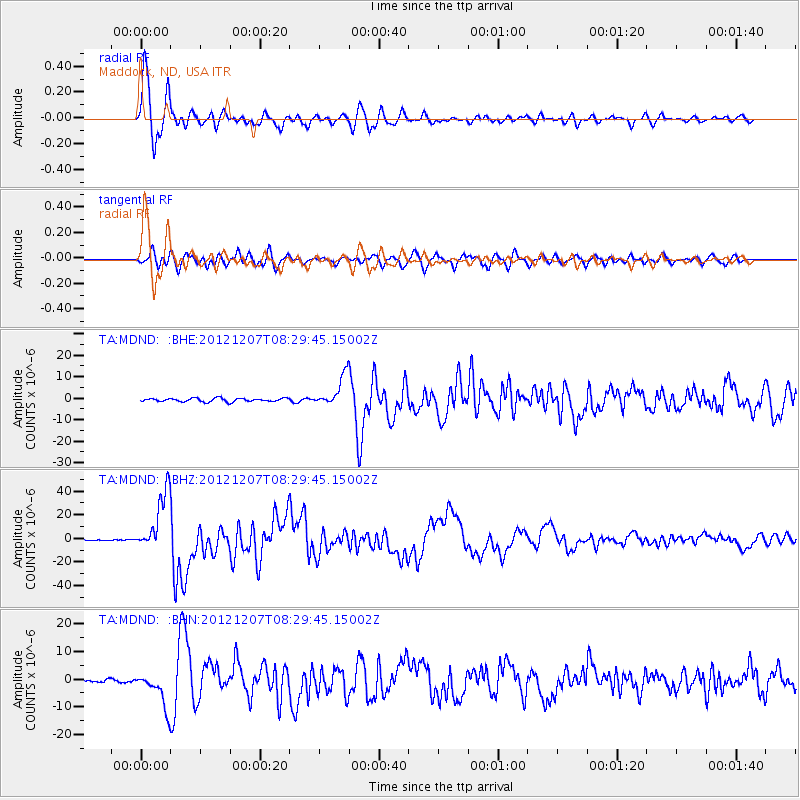
| Channel | StoN | STA | LTA |
| TA:MDND: :BHZ:20121207T08:29:45.15002Z | 135.32317 | 2.550106E-5 | 1.8844564E-7 |
| TA:MDND: :BHN:20121207T08:29:45.15002Z | 9.707872 | 6.2454296E-6 | 6.433366E-7 |
| TA:MDND: :BHE:20121207T08:29:45.15002Z | 8.832084 | 7.1448967E-6 | 8.0897064E-7 |
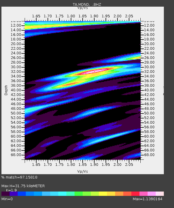
| Arrivals | |
| Ps | 4.5 SECOND |
| PpPs | 14 SECOND |
| PsPs/PpSs | 18 SECOND |

