J05D Fort Rock, OR, USA - Earthquake Result Viewer
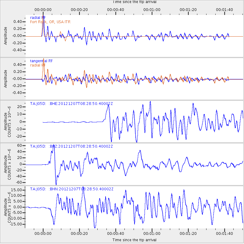
Earthquake location: Off East Coast Of Honshu, Japan
Earthquake latitude/longitude: 37.9/143.9
Earthquake time(UTC): 2012/12/07 (342) 08:18:23 GMT
Earthquake Depth: 31 km
Earthquake Magnitude: 7.2 MB, 7.3 MS, 7.3 MW, 7.3 MW
Earthquake Catalog/Contributor: WHDF/NEIC
Network: TA USArray Transportable Network (new EarthScope stations)
Station: J05D Fort Rock, OR, USA
Lat/Lon: 43.28 N/121.23 W
Elevation: 1541 m
Distance: 68.3 deg
Az: 51.538 deg
Baz: 301.966 deg
Ray Param: 0.056330316
Estimated Moho Depth: 24.25 km
Estimated Crust Vp/Vs: 1.69
Assumed Crust Vp: 6.597 km/s
Estimated Crust Vs: 3.915 km/s
Estimated Crust Poisson's Ratio: 0.23
Radial Match: 95.75034 %
Radial Bump: 400
Transverse Match: 87.71309 %
Transverse Bump: 400
SOD ConfigId: 488671
Insert Time: 2013-03-29 04:27:22.360 +0000
GWidth: 2.5
Max Bumps: 400
Tol: 0.001

Signal To Noise

ChannelStoNSTALTA
TA:J05D: :BHZ:20121207T08:28:50.40002Z84.387861.3869564E-51.6435496E-7
TA:J05D: :BHN:20121207T08:28:50.40002Z4.9795941.8842652E-63.7839735E-7
TA:J05D: :BHE:20121207T08:28:50.40002Z10.97477153.495007E-63.184583E-7
Arrivals
Ps2.6 SECOND
PpPs9.5 SECOND
PsPs/PpSs12 SECOND