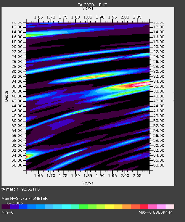
G03D McMinnville, OR, USA - Earthquake Result Viewer
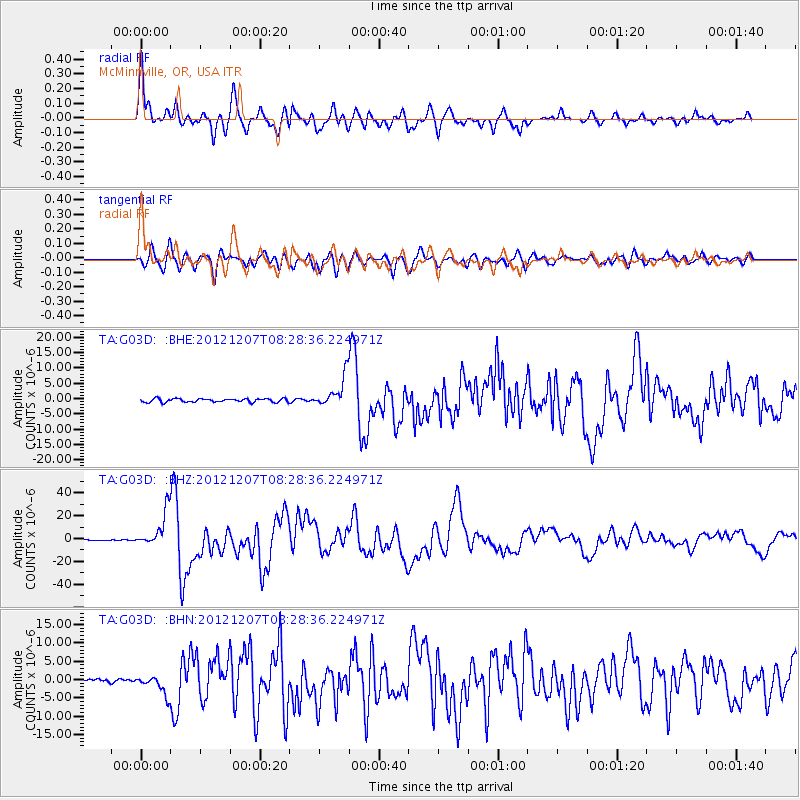
Earthquake location: Off East Coast Of Honshu, Japan
Earthquake latitude/longitude: 37.9/143.9
Earthquake time(UTC): 2012/12/07 (342) 08:18:23 GMT
Earthquake Depth: 31 km
Earthquake Magnitude: 7.2 MB, 7.3 MS, 7.3 MW, 7.3 MW
Earthquake Catalog/Contributor: WHDF/NEIC
Network: TA USArray Transportable Network (new EarthScope stations)
Station: G03D McMinnville, OR, USA
Lat/Lon: 45.21 N/123.26 W
Elevation: 222 m
Distance: 66.1 deg
Az: 50.565 deg
Baz: 300.177 deg
Ray Param: 0.057800677
Estimated Moho Depth: 34.75 km
Estimated Crust Vp/Vs: 2.09
Assumed Crust Vp: 6.566 km/s
Estimated Crust Vs: 3.149 km/s
Estimated Crust Poisson's Ratio: 0.35
Radial Match: 92.52196 %
Radial Bump: 400
Transverse Match: 87.15181 %
Transverse Bump: 400
SOD ConfigId: 488671
Insert Time: 2013-03-29 04:27:34.107 +0000
GWidth: 2.5
Max Bumps: 400
Tol: 0.001

Signal To Noise

ChannelStoNSTALTA
TA:G03D: :BHZ:20121207T08:28:36.224971Z29.070891.5349056E-55.279871E-7
TA:G03D: :BHN:20121207T08:28:36.224971Z7.29308132.578459E-63.5354864E-7
TA:G03D: :BHE:20121207T08:28:36.224971Z8.6665574.9883124E-65.755818E-7
Arrivals
Ps6.0 SECOND
PpPs16 SECOND
PsPs/PpSs22 SECOND