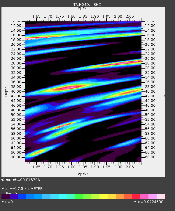
H04D Lebanon, OR, USA - Earthquake Result Viewer
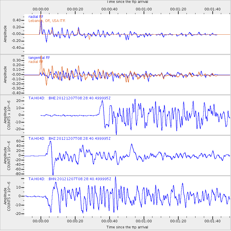
Earthquake location: Off East Coast Of Honshu, Japan
Earthquake latitude/longitude: 37.9/143.9
Earthquake time(UTC): 2012/12/07 (342) 08:18:23 GMT
Earthquake Depth: 31 km
Earthquake Magnitude: 7.2 MB, 7.3 MS, 7.3 MW, 7.3 MW
Earthquake Catalog/Contributor: WHDF/NEIC
Network: TA USArray Transportable Network (new EarthScope stations)
Station: H04D Lebanon, OR, USA
Lat/Lon: 44.52 N/122.74 W
Elevation: 284 m
Distance: 66.8 deg
Az: 51.006 deg
Baz: 300.723 deg
Ray Param: 0.05735778
Estimated Moho Depth: 17.5 km
Estimated Crust Vp/Vs: 1.61
Assumed Crust Vp: 6.566 km/s
Estimated Crust Vs: 4.078 km/s
Estimated Crust Poisson's Ratio: 0.19
Radial Match: 90.815796 %
Radial Bump: 400
Transverse Match: 83.86425 %
Transverse Bump: 400
SOD ConfigId: 488671
Insert Time: 2013-03-29 04:28:41.812 +0000
GWidth: 2.5
Max Bumps: 400
Tol: 0.001

Signal To Noise

ChannelStoNSTALTA
TA:H04D: :BHZ:20121207T08:28:40.499995Z40.4624751.5720185E-53.8851266E-7
TA:H04D: :BHN:20121207T08:28:40.499995Z8.4634183.4144887E-64.0344088E-7
TA:H04D: :BHE:20121207T08:28:40.499995Z7.77345943.890196E-65.004459E-7
Arrivals
Ps1.7 SECOND
PpPs6.6 SECOND
PsPs/PpSs8.3 SECOND